


03 May Dún Aonghasa (Dun Aengus)
“Here, with their faces to the foe, and their backs to yon yawning gulf, 300 feet above the surging sea, was the last stand of the ancient Firbolgs who fled to these islands and erected these stupendous monuments, when driven from the mainland after the battles at Moyturedh, centuries before our Christian era.”
Sir William Wilde, 1857 1
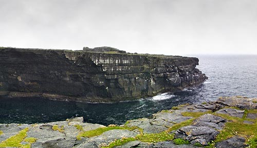
Click the image above to enter the virtual-reality tour.
As the legends recounted in the Lebor Gabála (Book of Invasions) would have it, the mythological race of the Fir Bolgs built Dún Aonghasa after they sought refuge on the island in the first century CE. They named the fort after their chieftain, Aenghus, King of the Clann Umoir, “the sterling pilot of his people who lives in legend as the founder and first lord of Dun Aengus.”2 His brother, Conchuirn, is reputed to have built Dún Chonchúir, which may be seen in a 360° view at the bottom of this page.
“The Fir Bolg gave them [the Tuatha Dé Danann] battle upon Mag Tuired; they were a long time fighting that battle. At last it broke against the Fir Bolg, and the slaughter pressed northward, and a hundred thousand of them were slain…The Fir Bolg fell in that battle all but a few, and they went out of Ireland in flight from the Tuatha Dé Danan…They were in fortresses and in islands of the sea around Ireland in that wise, till Cu Chulaind overwhelmed them. ” 3
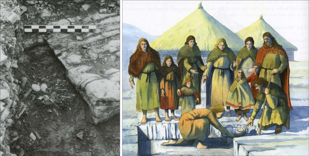
Bronze Age infant burial.
Curiously, in 1891, inspired by Darwin’s theories of evolution as well as by the mytho-historical Irish chronicles, two renown Trinity College professors traveled to the Aran Islands. These two scientists, Charles Browne and Alfred Haddon, were determined to assess the islanders, who were thought to have descended from the mythical Firbolgs, for their physical and mental properties so that they could be “graded for potential ‘Firbolgery.’”4 The islanders, in the 1893 report, were revealed to have traits of honesty, generosity, and an enviable moral fibre. Their eyesight, in particular, was deemed extraordinary:
“The range and distinctness of the vision is astonishing, as we have had occasion to know; and we are informed by [the island’s] Dr. Kean, that on a clear day, any of the men whose eyesight is average can, with the naked eye, make out a small sailing boat at Black Head, 20 miles away, before he [Dr. Kean] can see it with a good binocular.” 5
Based upon this assessment, the scientists concluded, “To what race or races the Aranites belong we do not pretend to say, but it is pretty evident that they cannot be Firbolgs, if the latter are correctly described as small, dark-haired, and swarthy.”
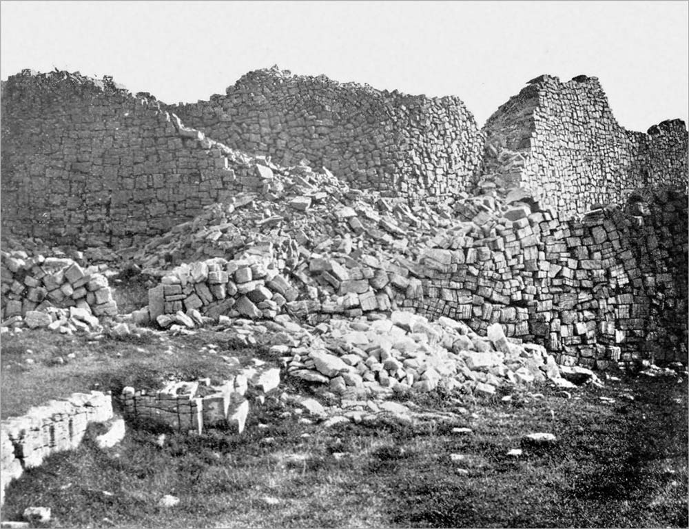
The inner fort before restoration.
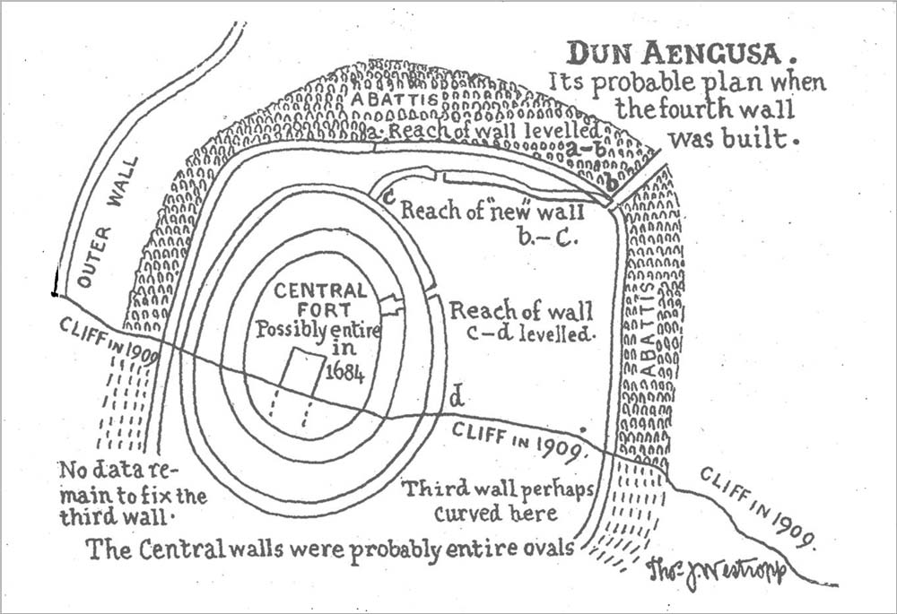
The earliest account of Dún Aonghasa was written by Roderic O’Flaherty in 1684. But by the time T. J. Westropp visited the fort in 1909 it was already too late to see it in its original form. Poorly conceived and badly documented restorations in 1884 and later had removed some features and added others—principally the massive stone buttresses of the inner wall—but Westropp was undeterred.6 His Study of the Fort of Dun Aengus considered every detail of this cliff-side wonder of the western world, from its origins in mythology to the intricate details of its dry-wall construction.
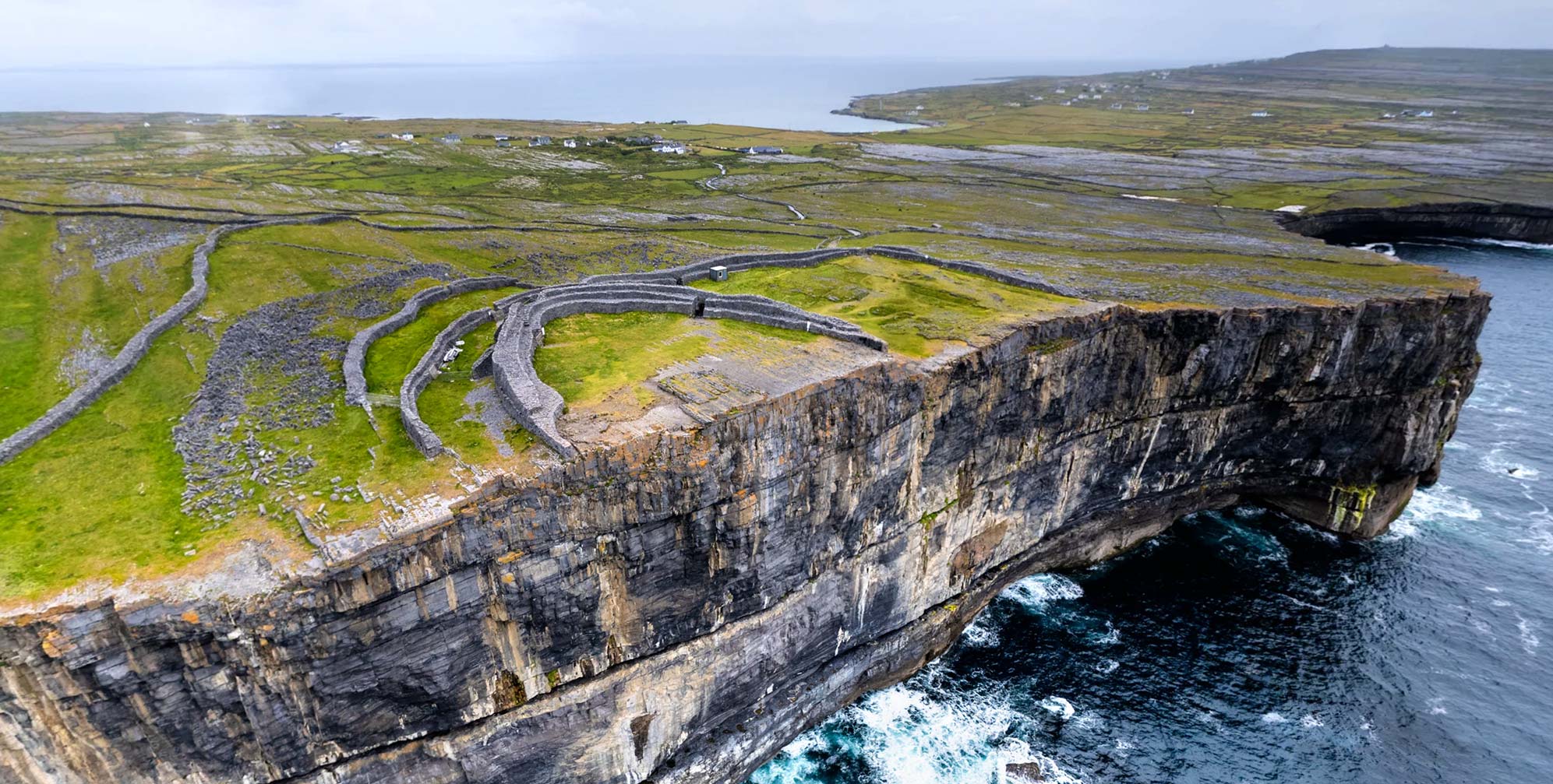
Dún Aonghasa is precariously perched on the edge of a vertical cliff on the westernmost Aran Island of Inis Mór (Inishmore). In the words of archaeologist Peter Harbison (RIP)—and as seen in the initial aerial view of our VR tour—the fort’s inner wall resembles “a set of false teeth which some gentle prehistoric giant left dangling behind him on the precipice.”7
Perhaps parts of it have already fallen down into the churning waters of the Atlantic nearly 100 meters (300 feet) below. As Westropp wrote:
“Whether the walls of Dun Aengusa were all crescents from the first we can never know; for they, their foundations, and the rock for over 300 feet beneath are devoured by the Atlantic and ‘their memorial has perished with them.’ We have no means of calculating the advance of this destruction; and it may have been very slow for centuries.” 8
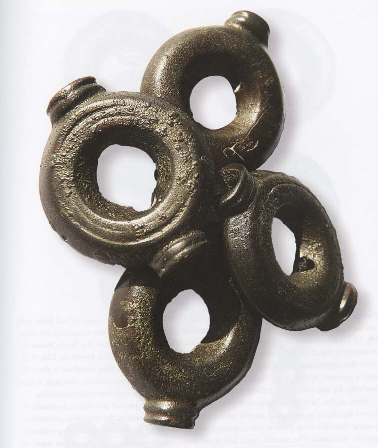
Hoard of Bronze Rings
Westropp’s 1910 diagram imagining the fort prior to such a collapse may be seen here. However, the only first-person description of a section of the cliff giving way stems from a tragic incident in 1837, when a fisherman was “precipitated into the sea” as the cliff collapsed beneath him.9 In recent years another Irish fort has been severely damaged by its exposure to the Atlantic’s fury. Our VR tour of Dunbeg on the Dingle Peninsula shows a before and after view of the fort.
Logically, there would have been no reason for the Inner Enclosure’s 2m (6.5 ft.) wall to extend to a full circle, as there would not have been a need for a tall defensive wall at the cliff’s edge, where the merciless ocean waves far below maintained an impregnable defense. More likely, there was a low wall in that position, simply as a barrier to prevent anyone stumbling over the abyss in the dark.
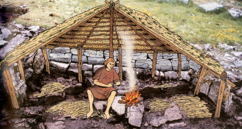
Late Bronze Age Hut
The four defensive walls at Dún Aonghasa, up to 4m (13 ft.) thick and 2m (6.5 ft.) high, form semi-circular bulwarks. These enclose an area of some six hectares (14 acres) and protect the innermost bastion at the southern edge of the cliff. Dún Aonghasa was built and first occupied in the Late Bronze Age (1100–1000 BCE). Similar structures in Ireland include Co. Donegal’s Grianán of Aileach, and Staigue Fort in Co. Kerry.
Because of Dún Aonghasa’s remote location, and the fact that it consists largely of naked rock with little soil cover, there were no detailed excavations by the earlier antiquarians. Also, it may be assumed that much of the remains of an extensive habitation that elsewhere might be uncovered in middens would here have been simply dumped over the cliff by the inhabitants.10
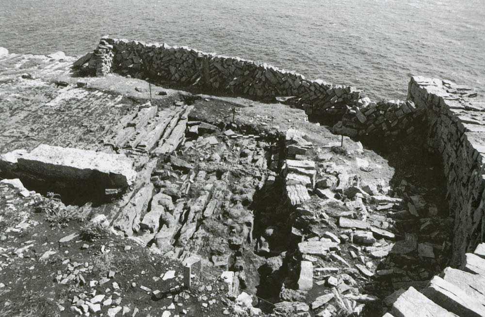
Four summers of excavations (1992-1995) undertaken by archaeologist Claire Cotter and her team for the Discovery Programme found evidence of circular huts from the fort’s initial Bronze Age occupation. Ouside the doorway of the foundation of a hut the remains of a stone-lined trough were found. This trough, which may have been used as a storage tank for shellfish, is noted in the VR tour. Sadly, some of the surviving stones of the trough disappeared during the time the fort was closed in 2002 in an effort to prevent the spread of foot-and-mouth disease.
The associated finds included pottery sherds, bronze rings, and fragments of clay molds used for making spearheads. The most significant of the human remains found from this period were those of an infant, seen in the photograph and illustration, above left. Dr. Cotter explains the project in this video.
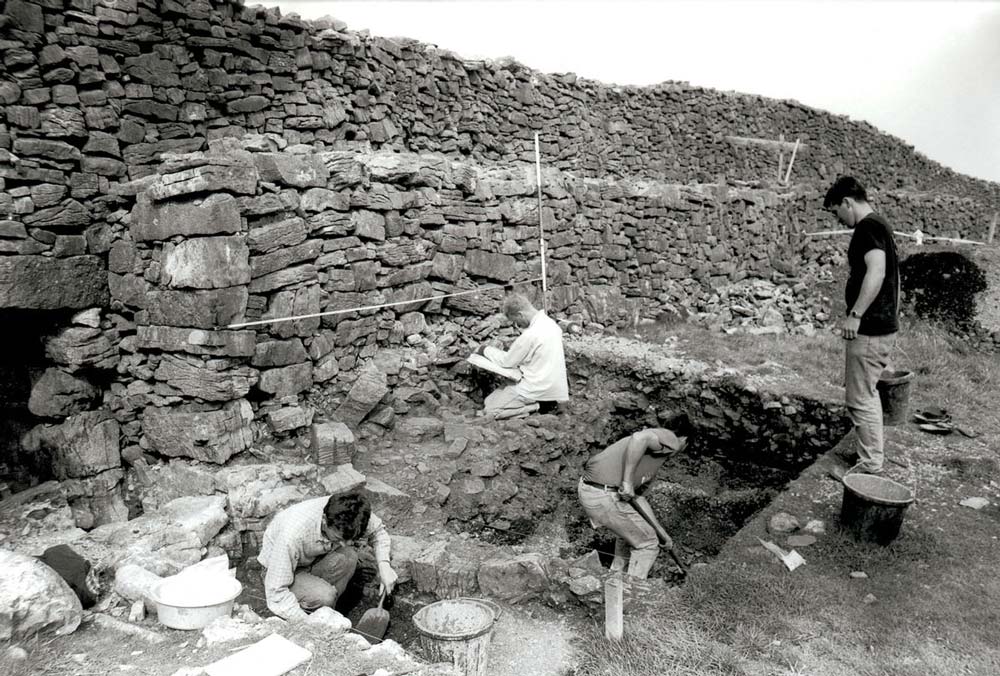
Excavation c. 1992.
The excavators gave a date of the Late Bronze Age for the initial construction of the fort (1100–1000 BCE). This first occupation of the fort lasted until around 700 BCE. Dún Aonghasa was rebuilt and strengthened in the Early Medieval period, around 800 CE.The original Late Bronze Age walls were around 2m (6.6 ft.) thick, but the walls constructed in the second occupation were double that.
Animal bones found with other occupation materials yielded a C14 date range of 900 – 700 BCE. At the threshold of the entrance passage was discovered the burial of a youth, dating from c. 800 -1100 CE. Amber beads, perhaps part of the burial, were also found.11
Click to view a VR tour of the chevaux-de-frise.
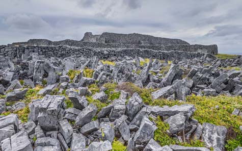
Perhaps the most striking feature of Dún Aonghasa are the menacing rows of chevaux-de-frise, sharp stones, up to 1.5 m (5 ft) in height. These were set into the bedrock at an angle to impede—or impale— an invading army. This tactical innovation is literally “Frisian horse,” named after an Iron-Age Germanic tribe which had no mounted warriors and relied on these anti-cavalry defenses. These can be seen clearly in the virtual-reality environment linked from the image to the left. Dún Aonghasa is one of only four sites in Ireland where this feature can be seen; the example here is thought to be the most impressive in the world. To both the friendly visitor as well as the potential foe, the chevaux-de-frise were a sign of power and wealth.12
When John O’Donovan saw them in 1839 he imagined a petrified army on the attack. Donovan stretched the truth somewhat with “many of them are so sharp that, if one fell against them, they would run him through.” Unfortunately, some of these stones, and other pieces of the fort as well, were removed by visitors to the fort in earlier times, who delighted in the sport of hurling them down the cliff to watch them careen into the ocean.13
The Discovery Programme
While excavation has determined that Dún Aonghasa was used as a habitation site, with alterations and refinements spanning perhaps a thousand years, other theories have been proposed by the different generations of antiquarians who came to explore the fort, beginning with Roderick O’Flaherty in 1684.14 George Petrie in 1834 called it “probably the most magnificent barbaric monument extant in Europe,” and promised his readers that he would present “a numerous collection of facts, the result of long and laborious research, and will venture on no conclusions excepting those which are authorised by satisfactory evidence.”15
Other writers, however, based their conclusions on the traditional quasi-historical literature of the Annals, or simply upon their instincts. Some concluded that Dún Aonghasa was primarily a place for the performance of religious rites. In 1825 John O’Flaherty claimed to find there “the remains of Druidism—open temples, altars, stone pillars, sacred mounts of fire worship…”16
W.Y. Evans Wentz, writing in 1911, maintained that
“In Dun Aengus, the strange…sun-temple, on Aranmore, we have another example of the localization of the Aengus myth…with its tiers of amphitheater-like seats…were anciently celebrated pagan mysteries…and initiations into an Aengus Cult such as seems to have once flourished at New Grange. Dun Aengus…so secure and so strongly fortified against intrusion, no doubt represented a somewhat different mystical school, and probably one very much older than at New Grange.” 17
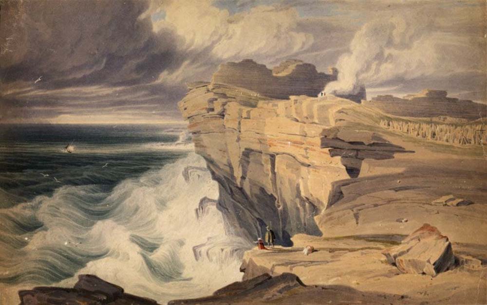
Watercolor by George Petrie.
The monument has been a focus of interest for generations, perhaps more than any other prehistoric monument in the country.18 When John O’Donovan first got a glimpse of the fort in 1839, he “…shouted with delight, and after launching his umbrella a marvelous height into the air, threw himself on the ground, and shouted again and again.”19 Yet O’Donovan noted that even the name—Dun Aengus—was lost to the native population. He found only one old man who remembered the ancient name, using its “correct Connaught pronunciation of Dun Innes.”20 Everyone else called it simply “Dunmore” (the big fort).
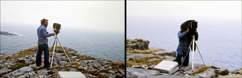
The author with his view camera in 1979.
Author’s Note: I began the documentary project that would become Voices from the Dawn in 1979. Inspired by the large-format photography work of Paul Caponigro, I lashed the case of my Sinar 4×5 view camera into a backpack frame and trekked about Ireland waiting for the decisive moment of light illuminating an ancient monument. On the inevitable cloudy-misty-rainy days I would park my small rental car as close as possible to the site, and sleep curled up in the back of the car, ready to jump out and get to work if and when the sun should emerge.

Click to view in high resolution.
The process with this camera involved measurements and calculations; measuring the light with a hand-held light meter and calculating the exposure with a cardboard device based upon Ansel Adam’s “zone system” of camera exposures and linked darkroom developing parameters. The intensely contemplative nature of this work—one image could take an hour or more of preparation—included studying the scene (projected upside-down) while underneath a dark cloth; in the case of Dún Anghosa, with the tripod leg right at the cliff’s edge.
This procedure has today evolved (or devolved, depending upon your perspective) into my using a drone to capture images for stitching into the 360° panoramas seen on this page. But the resolution and the fine gradations in tone of the view-camera images can still be appreciated using the digitized negatives within a zoomable interface, such as may be noted in the example from Dún Aonghasa, above right.
Click to stand upon the platform in a 360° view.
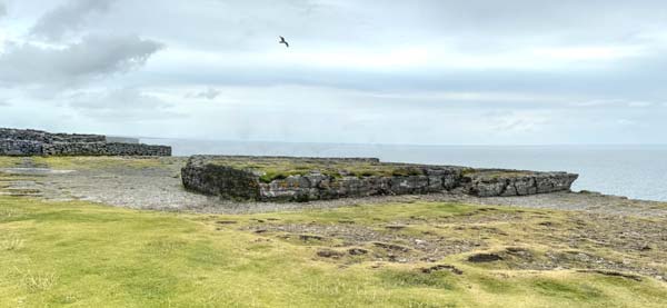
One distinctive feature of the Inner Enclosure is its massive stone “platform,” seen here in the VR tour. Upon entering the inner enclosure through its monumental gateway, the platform appears like a stage of stone before you, with the vastness of the Atlantic as its backdrop. The seascape from this vantage place extends uninterrupted for some 3000km (1864 mi.) before it meets the coast of Newfoundland.
Some of the early antiquarian visitors imagined the platform as the focus of sun-worshipping rituals in prehistory. The rock, the only feature interrupting the nearly level surface of the inner enclosure, was certainly left in place intentionally, and its stage-like appearance is not completely natural, with some evidence of the rock having been worked. Of course, we have no way of knowing now whether or not the platform had any ritual significance for the builders or occupants of the fort.
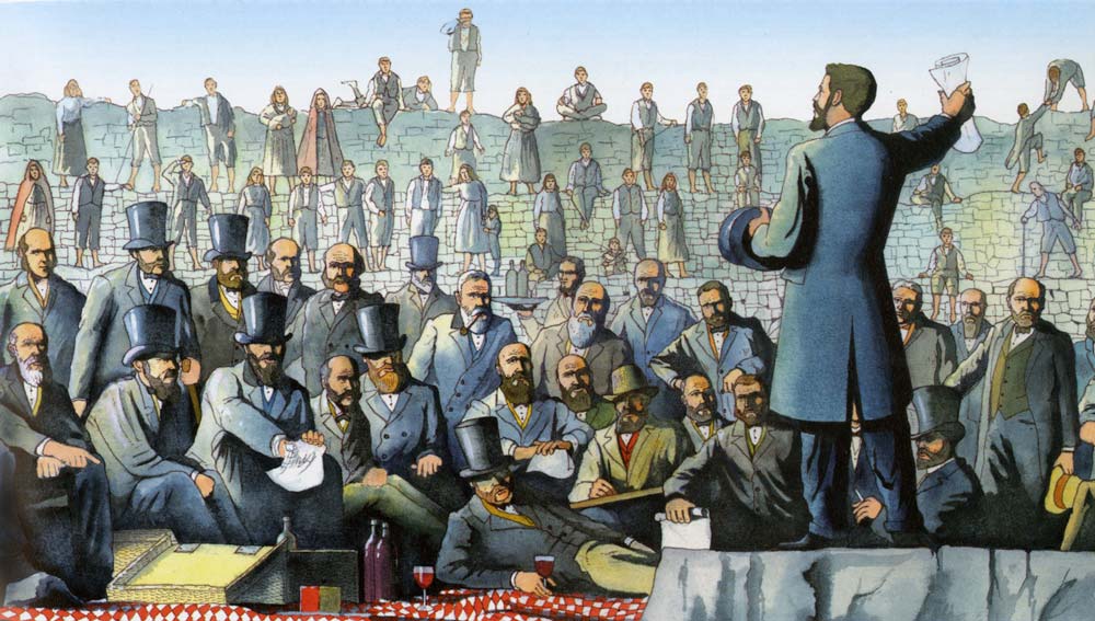
What we do know is that the platform served as the stage, as well as the buffet table, for what may have been the most illustrious group of 19th-century Irish eminences to have ever gathered in one spot. Dr. William Wilde’s quotation at the top of this page was delivered by him from the platform of the Inner Enclosure during the 1857 visit of the Ethnological Section of the British Association for the Advancement of Science. Dr. Wilde was the organizer and leader of the expedition—a physician with a worldwide reputation and also one of the finest antiquarians and folklorists of his time. The father of Oscar, he was no less scandalous than his son in the view of Victorian society.
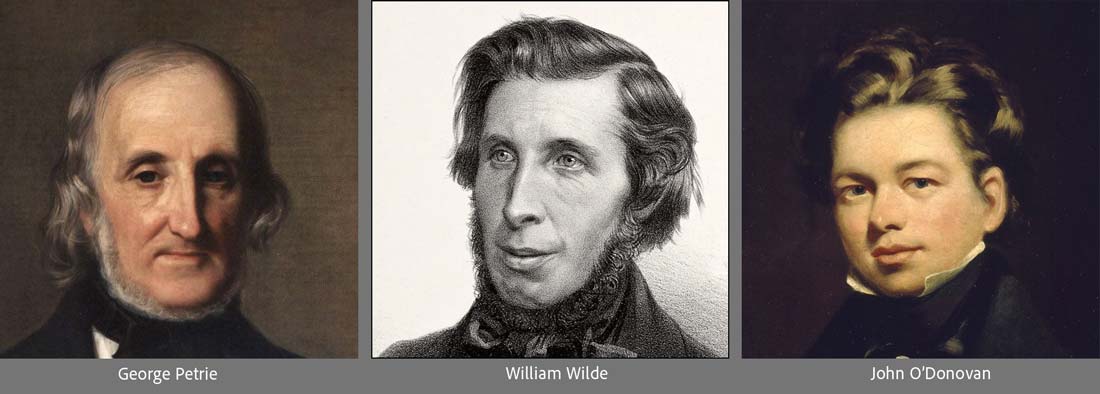
George Petrie, William Wilde, and John O’Donovan
A small sampling from the list of the 70 learned luminaries in attendance includes: Sir Samuel Ferguson, poet lawyer, antiquarian, historian and painter; Sir Joseph Lister, known as the “father of modern surgery” for his innovative use of carbolic acid to sterilize surgical instruments; John O’Donovan, most celebrated for his Ordnance Survey Letters; Eugene O’Curry, the leading authority on ancient Irish manuscripts; and George Petrie, archeologist, musician, linguist, architect, writer, publisher, surveyor, and painter of the watercolor featured above.
As one modern writer observed, “For three days in early September 1857, the islanders must have found it difficult to bring a bucket of water from the well without tripping over a Lord, Sir, Judge, Baron, Reverend, Professor, Captain, Doctor or even an Excellency.”21
The account of the group’s arrival at the fort demonstrates the emotion of the moment:
The 1857 Ethnological Excursion.
“This was our culminating point of interest — the chief end and object of our pilgrimage. To have seen this would have amply repaid any of the party for the whole fatigue and trouble of the expedition. This was the Dun Ængus, whose name is always associated with that of Aran, which it has immortalized in the mind of the archaeologist more than all the other remains of antiquity with which the island abounds. This was the Acropolis of Aran, — the Palace-fortress of the days of Queen Maeve, — the venerable ruin which Dr. Petrie, in his evidence before a Government Commission in 1843, described as ‘the most magnificent barbaric monument now extant in Europe.’ We can here only describe its dimensions, its remote antiquity, its site on the beetling brow of the precipice, its walls, now reduced to little more than crumbling piles of loose stones; but the indescribable feelings of sadness, and awe, and enthusiasm, which the place itself inspired, cannot be conveyed to the reader by any words of ours.” 22
An author in 1945 told of his excitement upon finally reaching Dún Aonghasa, about how he marveled at its timeless, stark beauty and the thrill of being close to the perilous drop of the cliff edge. On the voyage back to the mainland, he poured out his emotions to the boatman, hoping to gain an even greater appreciation of the site by learning what a native Aran Islander thought about the fort. He asked the boatman, ”’Won’t you tell me something of all that Dun Aengus means to you?’ His eyes took on their dreamy, cloudy look. His mouth softened. He spoke: ‘Och, I never was there. I’d rather a pint of porter.’”23
Today’s visitors, however, would seem to enjoy both their porter and their visit to the fort. Some of them get a visceral thrill from lying down on a seaward edge of the fort, 300 ft. above the furious waves, their heads just jutting over the abyss. This author, however, prefers the deep sense of connection with the continuity of human presence at the fort—standing atop the stone platform of the Inner Enclosure, imagining the impassioned followers of a pagan deity directing their gaze to their priest standing in the very same spot. Or imagining in the same position the stirring oratory of William Wilde and the other luminaries at the banquet of 1857. Right on this spot.


“In the first century I would have broken
my back to help build this ring fort to fight
invaders from the West, the stones we snap
dragging behind me and a dozen others,
while you prayed I might return with my head
uncrushed and my limbs young enough to clutch.Two thousand years bring us here on bicycles.
We read about Dun Aengus: guidebooks grant us
foreignness. I drop to my belly, slither
to the edge, stare down three hundred feet, where sea
leaps upward, battering the cliff. I must
back off, get gone, even were you not screaming,
even were there something here for us,
some plunder or possession we could grasp
and look out to the West, the sea, and home.” 24
Jay Grover-Rogoff, “Dun Aengus,” 1985
Dúchathair (the “Black Fort”)
Click for a VR tour of Dúchathair.
Inishmor’s other promontory fort, Dúchathair (the “Black Fort” ) sits on the island’s south coast, in stark isolation at the end of a narrow rocky isthmus. It may be as old as Dún Aonghasa (late Bronze Age) but without any evidence from excavation it is more often ascribed to the Iron Age or Early Medieval periods.
The fort’s stone walls enclose an area of some 50 by 27 meters (164 x 89 ft.). The wall is up to 6m (20 ft.) high and 5m (16 ft.) wide in places, with terracing and steps on its inner face. Inside are the reconstructed remains of at least four ‘clochan type’ stone structures, which were likely once covered, perhaps with wattle and daub. These may have been dwellings, or perhaps storage places. The ruined foundations of a second group of huts are visible in the VR tour just along the far edge of the promontory. Outside the fort, protecting its entrance, there is a chevaux-de-frise defensive barrier, similar to that found at Dún Aonghasa. Due to its exposed location, Dúchathair has suffered severe erosion since it was first recorded by the Ordnance Survey in the 19th century.
The fort may have been inhabited until the late medieval period, when it was abandoned or destroyed by invaders. Dúchathair does not appear in any historical records or legends, unlike Dún Aonghasa. However, in local folklore a story suggests that it was once occupied by a fierce warrior named Goll Mac Morna, who was exiled from his clan after killing his brother.
There are no paved roads leading up to the fort, so the last mile of the trek to its promontory consists of a narrow sandy boreen followed by a choose-your-own-path through the fractured limestone on this extension of the Burren’s geology. As one visitor wrote, “…you could be forgiven for imagining that civilisation was wiped out long ago and that this lonely outpost is the site of the last battle between land and crashing sea.”
Other Aran Island Stone Forts
Click to explore Dún Chonchúir
(Inis Meáin).

Click to explore Dún Fearbhaí
(Inis Meáin).
Click here to see all the notes from this page.
Dún Aonghasa, Inis Mór, Co. Galway
Nearest Town: Kilronan
Townland: Kilmurvy
Latitude: 53° 7′ 31.35″ N
Longitude: 9° 45′ 47.35″ W
Many thanks to Claire Cotter and the Discovery Programme (and especially illustrator Paul Francis) for the use of images and other media elements on this page. The Western Stone Forts Project: Excavations at Dún Aonghasa and Dún Eoghanachta. (Wordwell, 2015)