
21 Apr Lough Gur
“Here where low-crowned limestone hills curve through the lough basin, prehistoric people settled on the well-drained sheltered soils…Red deer wandered in the trees alert for the wolf and the bears and for the barking of the hunters’ dogs. At the forest edges, where the land had been cleared, whitebeam, hawthorn and cherry blossomed, white as quartz, in the Springtime…Through the misting rains, the sunshine and the winds of centuries the slow life continued like a stone at the water’s edge while the years drifted by.”
Aubrey Burl, The Stone Circles of the British Isles, 19761
“In the past, no minstrel, piper, or poet would willingly spend a night within a mile of [Lough Gur’s] shore, such was its fearful reputation and potency. Even to fall asleep in daytime on its banks was considered among them to be reckless folly. The sense of danger arose from the belief that the original poets of Lough Gur were either descended from, or were demi-gods, like Geároid IarIa, able to draw human poets out of their depths.”
Michael Dames, Mythic Ireland, 19922
Drag within the image to explore 21 views of the Lough Gur monuments in virtual reality, beginning at the Grange Stone Circle. The interactive map may be toggled by clicking the “M” button in the toolbar at the bottom of the image. Touch here for the Google Cardboard version.
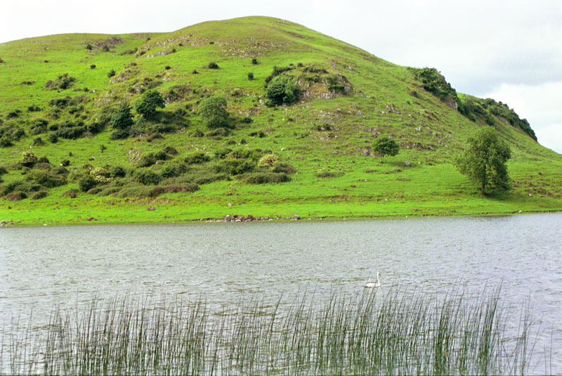
There is no other spot in Ireland so rich in the evidence of prehistoric habitation and ceremony, and also in the mythic traditions of men and gods. Lough Gur is but 22 km (13.7 miles) from the bustle of the modern city of Limerick, but it stands centuries apart in its symbolic landscape, and millennia distant in its magnificent Bronze Age stone circle, the largest in Ireland. There also are remnants of Neolithic dwellings, artificial islands (crannógs), ruined castles and churches, immense pillar stones, and a wedge tomb that yielded evidence of a ritual sacrifice. All this closely surrounding a scenic lake reputed to harbor a magical realm beneath it.
Lough Gur is today much different than it was in prehistory. Now resembling the open mouth of a dragon, the lake once formed a complete circle, with the present-day Hill of Knockadoon a large island on its eastern side.3 Drainage schemes in the 1840s resulted in the shape of the lake seen today.4 The water level was lowered by about 2.4 meters (8 ft) exposing much in the way of archeological treasures, such as the presumed votive offering of a small sword (photo below left).5 The lake today is a placid wildlife sanctuary where no motorized watercraft are permitted. The Interpretative Center, located in a reproduction of a Neolithic hut, offers displays and an audiovisual overview of the area.
“There’s a white horse that goes around that lake every seven years, you see. He only comes around when someone is to be drowned. And there was a couple drowned here, some drowned themselves. And more was drowned by accidents in boats.” 6
There is reputed to be a lake-sized version of Atlantis, a sunken city, beneath the waters of Lough Gur. Some have claimed, “When the surface of the lake is smooth, one may see from a boat the drowned city, its walls and castles…7

Tim Casey discusses the 1998 summer solstice sunrise; includes footage of the solstice event the following year (1999).
Writing in 1812, the credulous French engineer Charles Vallancey said, “It astonished me to see such immense irregular blocks and rocks under water, when nothing similar is to be found in the vicinity.”8 Wood-Martin suggested in 1895 that such legends might have resulted from folk memories of small homesteads built upon artificial islands in the lake, which later disappeared. There is evidence of at least three of these artificial islands, or crannógs, around Lough Gur.9
Geároid Iarla
Many of the stories of the enchanted Lough Gur center on the life and legends of Gerald, or Garrett, Fitzgerald, the third Earl of Desmond, the scion of the Munster branch of the Hiberno-Norman Geraldines. He died (some say he disappeared) in 1398. The island near the east shore of Lough Gur, Garrett Island, is named after him. He is known locally as Geároid Iarla, or Earl Gerald, in legend the son of the goddess Áine from nearby Knock Áine. From his mother he gained his powers of sorcery.
“Geároid lives there in the under-lake world to this day, awaiting the time of his normal return to the world of men. But once in every seven years, on clear moonlight nights, he emerges temporarily, when the Lough Gur peasantry sees him as a phantom mounted on a phantom white horse, leading a phantom or fairy cavalcade across the lake and land.” 10
The locals would explain to any visitor that Geároid, “…must continue this until the silver shoes of his horse wear out.”11 But the historic Geároid, who was the Chief Justice for Ireland in 1367, employed the magic of words rather than sorcery; he composed poetry in both Irish and French.12 According to Michael Dames, Geároid the man “came to emulate Lugh’s and Finn’s roles at Lough Gur in joining the world of men to that of the gods.”
“Geároid, son of an invader, a foreigner, was taken to the heart of the Lough Gur myth cycle, and installed there by local people as ‘an enchanted magician, a periodic rider, a lost leader whose return is awaited, and a feared King of the fairy host.’ ‘I am the son of the King of the Norman fairies and my name is Geároid Iarla’ was a verse still sung in Co. Limerick in I879.” 13

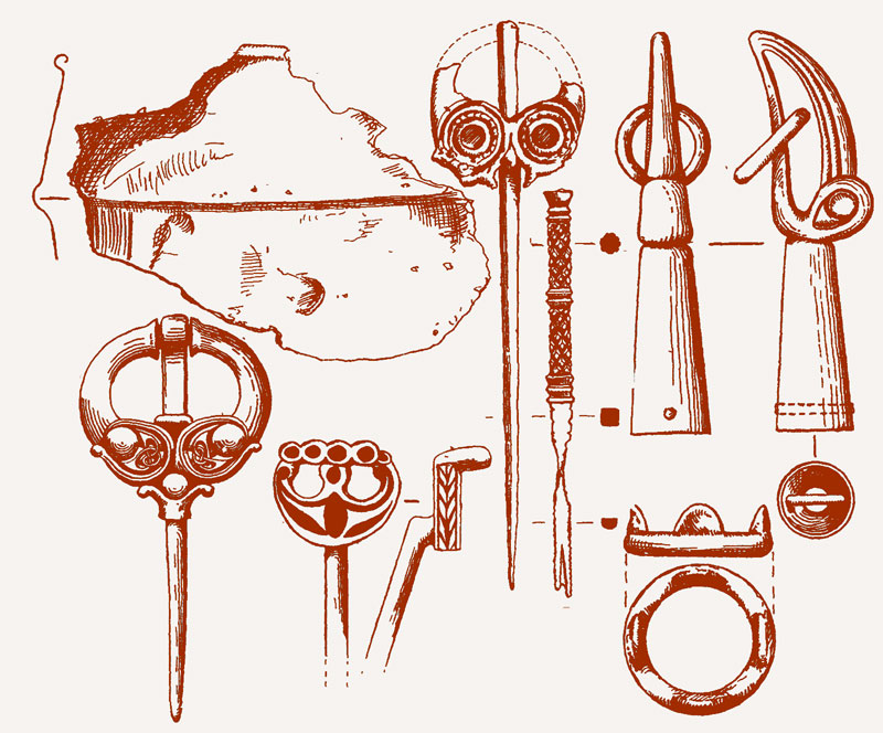
Iron-Age sword found in lake.
Tom McNamara
Each generation at Lough Gur has its acknowledged seanchaí, or storyteller. Tom McNamara served in that role for many visitors to the area, including this author. Tom was born in nearby Herbertstown, married into a Lough Gur family, and farmed on a hillside above the lake for most of his life. He learned the stories of Áine, Geároid Iarla, and Seán O hAodha and memorized them in such detail that when editing one of the videos below, shot in 1999, we were able to insert a few seconds of an audio recording of the same tale made in 1979 to cover a break in the narrative. Tom died at 75, just a couple of weeks before our planned reunion with him in 2001.
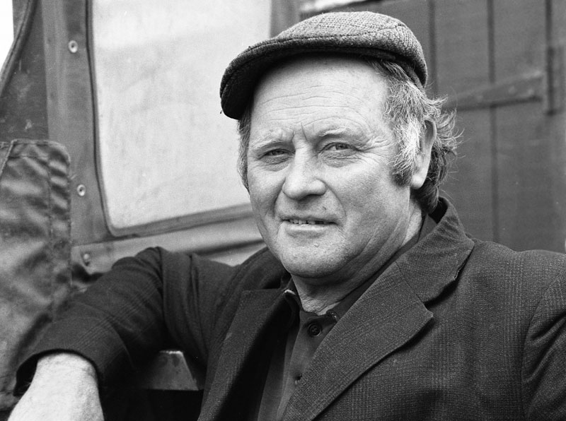
Tom McNamara in 1979.
Instead, we visited his gravesite and incorporated the scene into the extensive virtual-reality tour at the top of the page. Tom’s obituary observed that he “did not confine his story telling prowess to admirers as far way as Derry and Down to Knocknagoshel, and to the annual story-telling weekend at Lough Gur, but on many other stages was acclaimed as a scribe, actor, lover of drama, poetry and anything that added to the betterment of life around his beloved Lough Gur.”14
Michael Dames (Mythic Ireland) understands Tom McNamara’s traditional tales of Lough Gur to be centered in the primal mythological underpinnings of culture and identity. In “The Green Cloak,” (below) the Tree of Life is covered by a green cloth, perhaps representing Ireland, snatched away although protected by the “Otherworld goddess, perhaps Áine…This ambiguous scale is a feature of the task that all deities take on, in proposing microcosm and macrocosm as interchangeable terms.”
“Irish folklore resounds on a mythic frequency. Traces of the primary sacred narratives permeate its apparently inconsequential scraps. This is because they represent a collective wisdom and speak with an open voice, unconstricted by the claims of excessive individualism, and so are relatively immune to disruption by personal mortality. Instead, by word of mouth, folklore opens a free passage between the generations.” 15
Through a geopolitical lens, the reputed union of Geároid Iarla’s father, Maurice Fitzgerald (Second Earl of Desmond) with Áine, the goddess of Munster sovereignty, may have done much to gain the acceptance of this Norman family into the local Irish community.16 The wondrous stories of Áine “the enchantress” and Geároid Iarla told below by Tom McNamara would have helped to maintain the special status of many generations of Geraldine chieftains.
“These tales also were intended to be read aloud. The thick growth of alliterative adjectives would roll trippingly on the tongue of a practised story-teller, and have the effect of impressing his illiterate audience…” 17
Tom McNamara’s Lough Gur Folklore Videos
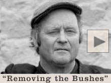
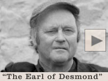
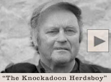
Eight traditional tales of Lough Gur are recounted here by Tom McNamara, who morphs from age 53 to 73 in the video thumbnails below. Tom first told us these stories for our audio recorder in 1979. But those presented here, except the first, were videotaped in 1999. In order (l-r) they are: “Removing the Bushes,” “The Earl of Desmond,” “The Knockadoon Herdsboy,” “The Green Cloak,” “The Laundry Girl,” “The Dead Hunt,” “The Golden Comb,” and “The Invading Eels.” Once he got started, Tom could proceed through his repertoire for hours, but these are a representative sampling.


The Monuments
The fertile soils around Lough Gur have been a beacon for human habitation since the first Neolithic peoples arrived 5,500 years ago. They have left behind archaeological evidence from each period, from the Stone Age to the Medieval and beyond. There are more than 130 listed sites in the area. Our virtual-reality tour (upper left) features a number of these sites most significant to the folklore of the area: The Neolithic wedge tomb; the Bronze Age monuments of The Grange Stone Circle (the Líos) and two other circles, plus the habitation site on Knockadoon and two standing stones; and the post-Medieval ruined Teampall Nua church (Tom McNamara’s gravesite). There are 21 different views, exploring 11 different sites around the lake.: The Grange Stone Circle (6 views), Circle C (3 views), the pillar stone, the wedge tomb, the Stone of the Tree, the Spectacles, the Knockadoon Habitation Site, Carraig Aille Stone Forts, the New Church Graveyard, Bolin Island Crannog, and panoramic aerial views of the lake and the Visitor Centre. The satellite perspective proves an overview of the Lough Gur area.

The 1999 summer solstice sunrise at the Líos.
There are other Lough Gur sites not included in our tour but well worth exploring. These include the interactive exhibits at the Visitor Centre, remnants of Neolithic houses, and the lime kiln. Bourchiers Castle, which may be seen on the lakeside walk toward Knockadoon Hill, is not open to the public. Black Castle, now in ruins, guarded the southern access to the Hill of Knockadoon when it was surrounded by the lake.
The thirteen sites described below are all accessible from the virtual-reality tour (top). Those that are in a line of sight from one to another are directly linked with hotspots. Others, located in different areas around the lake, must be accessed using the interactive map, which may be toggled by clicking the “M” button in the VR’s toolbar.
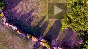
The Grange Stone Circle (The Líos)
The largest stone circle in Ireland is found around 300 m (1,000 ft) from the western edge of Lough Gur. Also known as the “Líos” (enclosure), this ring of 113 stones encloses a platform raised 60 cm (2 ft) up from the surrounding field. It has a monumental stone-lined entrance facing the rising sun of the summer solstice. Two grand portal stones, around 2 m (6.5 ft) high, stand at either side of the entrance. Much broken pottery was found upon its excavation. One beaker vessel was reassembled from its shards (see photo in gallery below).18 It differs from all other Irish stone circles in that its stones are contiguous, forming a completely enclosed circular ceremonial space 149.5 m (490.5 ft) in circumference and, including its wide bank, 65 m (215 ft) in diameter.19 Aubrey Burl estimated that the space could hold more than a hundred dancers in an imagined Bronze Age celebration.
“There was a squalid camp for the hundred or more workers on the west where fires burned and where refuse and filth gathered occasionally strewn over with earth as the months of labour continued. People carried baskets of clay from the shores of the lough. Other dragged stones whose weight tore and gouged the interior of the circle. Yet more manhandled the packing-stones to the pillars that were being pulled upright by gangs hauling heel-deep on the bank’s top…” 20
The Líos at Sunset.
The Líos sits on the farm of the Casey family, who live in the farmhouse across the road. Until his sudden passing in 2018, Tim Casey was an exceptional caretaker of the site, erecting fencing at his own expense to control the access by his lawn-mowing calves. His daughter Annie narrates the evocative audio guides available at the Lough Gur visitor’s center. Always hospitable and eager to talk with visitors, Tim and his family would mingle during the summer solstice sunrise with the eclectic crowd of drum-circlers, pagan spiritualists, and modern-day Crom Dhubians (see video, top right). If you visit the Líos, please don’t hesitate to drop a couple Euros into the box provided to assist in the upkeep of the site. If you visit in virtual reality (top) you will find that the Líos may be examined in 360° detail from six different vantage points. You may use the interactive map, or click the red spiral hotspots to navigate from site to site. The VR tour is optimized for full-screen viewing on a desktop or laptop computer, but will also allow viewing on a mobile device. There is also a HMD (head mounted display, e.g. Google Cardboard) version available.
Seán P. Ó Ríordáin excavated the Grange Stone Circle in 1939.21 During the excavations he found more than 4,000 sherds of pottery, dating from the Early Neolithic to the Late Bronze Age, spanning a period of some 2,600 years. Professor Ó Ríordáin postulated that the circle dated from the Late Neolithic. Archaeologist Helen Roche, however, with the benefit of radiocarbon dating and a modern understanding of pottery timelines and excavation stratigraphy, has suggested that the Líos was constructed in the Late Bronze Age (c. 1000 BCE) on a site that may have been sacred for thousands of years.
“The presence of earlier types of pottery on the site…[indicates that] the construction of the impressive Late Bronze Age enclosure was the result of an enduring tradition of a particular sacredness at this specific place…Grange was a site of great importance, most likely of a ritual nature, from possibly as far back as the Early Neolithic period.”22
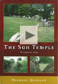
Michael Quinlan reads an excerpt from his novel The Sun Temple.
Crom Dubh
The largest stone of the Líos, the 55 tonne (60 ton) 2.5 m ( 8 ft) tall squared behemoth to the north of the entryway, has acquired the name Rannach Crom Dubh (the Staff of Black Crom). This stone, which extends a further five feet underground, is thought to have been dragged to the Líos from its source around 1.5 km ( a mile) away, demonstrating its importance in the construction.23 Crom Dubh is thought to be the “stooped black man” who in legend first brought wheat into Ireland, bending under its weight. He was associated with harvest celebrations well into the nineteenth century. Crom Dubh remains a focus of the modern celebrants of the summer solstice sunrise to this day (see photo, below left).
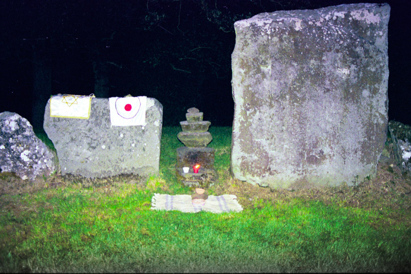
The massive pillar known as Crom Dubh (right) is next to makeshift altars set up during the summer solstice sunrise in 1999.
“Crom was bent because he carried seed. He bore on his shoulder whatever had to be endured in order to ensure the continuance of life, and in this way he served the goddess Ériu [Ireland]. He was dark because he had been under the earth to find the grain.” 24
It was customary into the middle of the twentieth century to leave garlands of flowers on the pillar during the harvest festival (Lughnasa).25 Next to the massive stone is a smaller stack of stones, said to represent Eithne, the Corn Child. She was the fairy mistress of the dark Crom Dubh, the god of the harvest. This stack of stones, festooned for the solstice event, may be noted in the photograph.
The excavator of the Líos, Professor Ó Ríordáin, had his doubts regarding the authenticity of the Crom Dubh legends. He suspected that the name may have originated with a “hedge schoolmaster of the eighteenth century” who knew of the legendary tales of St. Patrick overcoming the pagan deity of Crom Cruach, and then applied the story to the stones of Lough Gur’s Líos.26 Maire MacNeill, however, points to Rannach, a word not found in modern Irish, as evidence that the name is unlikely to have been a late invention.27
Whatever the authenticity of the Crom Dubh tale, Professor Ó Ríordáin had no doubts that the Grange Circle was “sacred and ritual in purpose.28 He suggested that all the sherds of broken beakers might have been the result of a ritual involving the drinking of beer followed by the deliberate breaking of the vessels on the stones of the Líos.29 In his novel The Sun Temple, local author Michael Quinlan created a dramatic scene that culminated in just such a ritual. The author reads this selection from his novel in the audio feature, above right.30
According to Tom McNamara, there were other local stories regarding the stones of the Líos:
“There was a Mrs. Webb up in Knockderk, who claimed she was a person who could see back in the past. She said that circle was a place of sacrifice. She saw a young girl being dragged to the center of that circle, and there these priests, or whatever they were, with robes and all the rest of it. And she saw her being sacrificed, and dead…And she pointed the spot out to Professor Ó Ríordáin who excavated the place.” 31
Click to view each stone in the Líos in a virtual-reality panorama (adapted from Ó Ríordáin, 1952).
The Summer Solstice Sunrise
On June 27th 1998 the front page of the Limerick Leader described the extraordinary scene the previous Sunday morning as landowner Tim Casey joined the crowd of about 40 celebrants awaiting the summer solstice sunrise (see newspaper clipping in gallery below). “Tim saw the famed beam of sunlight shining directly through an opening in the great stone circle of Lough Gur.”32 It was a fairly rare occurrence for the sunrise to be unobstructed by clouds; those who had camped out all night in the Líos were richly rewarded. When we arrived for the solstice event the next summer, the skies were not quite so accommodating, as the beam of light had to contend with some clouds on the horizon. But, as seen in the video, top right, it was still a remarkable experience. Fire barrels were blazing to help ward off the biting cold. Some people danced to the constant drumming, their motion also a way of dealing with the cold. Fire-spinners and other modern necromancers helped to usher in the first light of dawn. The Summer Solstice celebration has now grown even more eclectic.
It was clear to this observer that each of the celebrants came to the Líos that cold night for their own reasons. Some decreed their devotion to the Celtic god of the harvest, burning candles on the altar set up before the looming Crom Dubh orthostat. Others were ever mindful of the celestial alignments of the stones, in particular the eminent arrival of the solar rays onto the V-shaped axial stones opposite the entrance.33 One person was making circuits around the bank of the Líos, chanting softly while banging on a small drum (see video). One group of women, mindful of the connection between Lough Gur and the enchantress Áine, greeted the sun goddess at the stone circle and then drove to Knock Áine, some 5 km (3 mi) to the SE, to dance to her spirit (see video on Knock Áine page). What was shared by everyone that night was an amorphous but deeply felt connection to the spirits of the people who built the Líos and did their own dancing in this stone circle on a summer solstice thousands of years ago.


Other Grange Stone Circles
In the field just to the north of the Líos, and linked from the VR environment, sits another circle, smaller in size and with some of its stones removed for road building many years ago. Archaeologists refer to this monument as circle “C” (the Líos is circle “B”). This circle (actually an oval), has a larger diameter of 17.4 m (57 ft) and has a 1.5 m (5 ft) orthostat for its tallest stone. The largest stone circle in the area, even larger than the Líos, no longer exists. It was designated as circle “D,” and it stood in the same field as circle “C.” Travelers in the eighteenth century, when writing about the great stone circle by Lough Gur, may have been referring to this lost circle, which was so large that there were cottages inside it.34 A local legend held that this circle was stolen by Merlin and brought over to England to create Stonehenge.35
Circle “O”
“There was two people going to a dance in Herbertstown…And they were going out by that stone circle, probably forty or fifty years ago. And they saw a ball of fire coming down from the hill. It was at night, and they saw it actually hop along, a big ball of fire! It came into the center of that circle, and it disappeared! It was never seen again, but the boys were in a fair sweat, I can tell you.”
Tom McNamara, 1979 (this story is included in the “Removing the Bushes” video, above left)36
Circle "O"
Located in the field just across the road from the McNamara home, circle “O” is a double circle, described variously as a burial or a ritual site. It was once locally called the “Lisheen.”37 It has a diameter of 56 m (184 ft), but its shape may be difficult to discern because of field wall encroachments and fencing. It consists of a circular bank with an incomplete circle of stones at its outer border, and a central bank with another 33 stones at its outer edge, the highest being 1.2 m (4 ft). A detail of the circle, photographed in black and white with a 4 x 5 view camera in 1979, may be seen here.
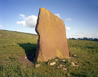
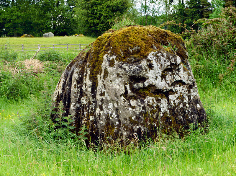
The Pillar Stone
From circle “O,” a walk up the boggy hillside of Ardaghlooda (Paddock Hill, or The High Hill of Lug)38 will cross an old trackway called Cladh na Leac (Mound of the Slab). There, standing all alone on the hill is a lichen-encrusted broad monolith known at the Pillar Stone. It stands 3.5 m (11.5 ft) tall, although it learns sharply to the east. It is 1.5 m (5 ft) wide. Some have suggested that the west face of the stone was worked to make it appear almost concave. The old trackway passes by the foundations of ancient hut sites and field walls. In the VR tour, the Pillar Stone is linked from the ground-level view of Circle C.
The Pillar Stone
Regarding the Pillar Stone, Tom McNamara remembered that “…there was a nun supposed to be seen in that vicinity. She was doing her rounds about the stone. There was at one time many years ago a nunnery in that area, but this nun was seen years later, all alone, doing her rounds.”39
The Stone of the Tree. The Grange Stone Circle (the Líos) is in the background at the left.
The Stone of the Tree (Cloch a’ Bhíle)
In the field to the south of the Líos, and linked to the initial aerial view in the virtual-reality environment (top) is a hoary-looking 2 m (7 ft) standing stone that is known to tradition as the “Stone of the Tree,” seen as a Celtic version of the Tree of Life. It is connected in myth to the magical tree growing on the bottom of Lough Gur, said to rise up to the surface once each seven years. Its moss and lichen covered mantle gives it an organic appearance (see photo at left) that resonates with the story of “The Green Cloak,” as told by Tom McNamara in the video (above).
“There’s a tree inside, in the lake, and there’s a green cloak over it, or a Brat ‘Uaine. And there’s a woman under it keepin’ watch at it. And the water is all dropping, this woman is there under it, and she’s knitting, and she’s keepin’ watch under the green cloak.” 40
The Hill of Knockadoon
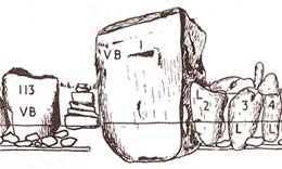
The circle of stones seen in the virtual reality tour outlines the remnants of a wall around a Neolithic home site. This is one reason that the Hill of Knockadoon is noted as “the greatest concentration of Neolithic structures on any single site that is known in Ireland.”41 Nearby are the foundations of several other Stone Age huts. Professor Ó Ríordáin’s sketches of how they might have appeared are in the gallery below. In the VR tour, the view is centered on Circle K, one of two on the Hill. Circle J, not visible, is is 180° opposite. Circle K has a diameter of 31 m (102 ft), and consists of two concentric rings.
The Knockadoon Enclosure
These rings may have been the inner and outer bulwarks of a taller earthen bank. In its center there was found evidence of a rectangular building, outlined by rock-cut postholes This may suggest that Circle K was a domestic or a defensive structure, and not a ritual stone circle such as seen elsewhere around the lake. This peninsula, once a more easily defended island, was first occupied in the Early Neolithic, and continued to be a population center well into the Bronze Age.42
The Neolithic structures were built upon rough stone foundations, both circular and rectangular, and were likely made of wattle and daub, with thatched roofs. The Lough Gur Visitor Centre was designed to outwardly resemble these forms. While the nearby wedge tomb (see below) may have been the primary center for interment and ceremony for this population, there were also burials found within these domestic sites. Near Circle K were found the remains of nine children and one adult woman, who may have died during childbirth. Tom McNamara, who claimed that he heard the banshee crying at this site, said that the locals believe that ” the mother died while giving birth, and the children died afterwards as there was no one to look after them.”43

Author Michael Quinlan recounts the tale of the Knockadoon Money Hole (2001).
Local legend holds that a Geraldine chieftain buried a treasure within the Knockadoon circle before he went into battle, putting the body of a dead soldier over it as a guardian. It is said that the soldier’s spirit, in the shape of a bull, guards it still. Michael Quinlan recounts this tale, “The “Knockadoon Money Hole,” in the video at right.
In one of Tom McNamara’s videos (above) he tells the wonderful story of what happened when the enchantress Áine recruited Seán O hAodha, “The Knockadoon Herdsboy,” to be the piper at Geároid Iarla’s mansion under the lake.
Near the Neolithic enclosures on Knockadoon there is a cave with a mouth 3 m- (10 ft-) high, once occupied by “a mysterious old man and his wife.” It is reputed to be a magical entrance to Tír na nÓg, the Land of Youth, a place to the West, but “beyond the edges of the map.”44
“Entrances to Tír na nÓg occur throughout Ireland. They are found in lake-isle caverns (as at Knockadoon), down wells, under lakes, or where the sun sets, or on islands in the Western ocean. These doors all led towards music (often played on a harp), a magic tree (frequently of gold or silver, from which a sacred branch was plucked), divine horses and birds, of dazzling colours, a banquet where a cauldron of ale was always full, and where an unearthly kind of Time was enjoyed. Central to the vision, its source and overseer, stood the figure of a beautiful woman. Combining generosity with authority, she was the goddess revealed.” 45


From near the Housekeeper’s Chair, Ardaghlooda Hill is seen across the lake.
The Housekeeper’s Chair (Suideachan Bean-tige)
At the foot of the Hill of Knockadoon, right at the shore of the lake, a natural rock formation resembling a ship’s prow juts out toward the water. It is known to folklore as the Suideachan Bean-tige, or the Housekeeper’s Chair. The Housekeeper, or Bean-tige, was the fairy that acted as the caretaker of Geároid Iarla’s submerged castle. Some consider her to be yet another manifestation of the enchantress Áine. As the story relates, she fell asleep on her chair and a little herdsboy passing by decided to steal her golden comb. The outcome of this daring act of larceny may be learned by listening to the tale “The Golden Comb,” told by Tom McNamara in the video section above.
The rock formation was also known as Áine’s birthing chair, and it was considered an entry point to the fairy kingdom. In years gone by, the stories relate, some would catch a glimpse of Áine sitting on her chair. Unfortunately, those who glanced at her unearthly beauty would afterwards meet an untimely end or go mad from the haunting vision of the goddess.46
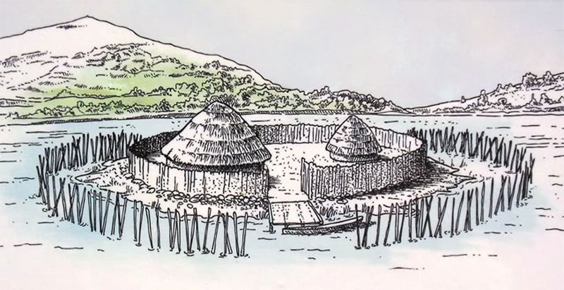
Bolin Island Crannog
Although it was constructed some distance from the shore, since the lake level was lowered in the 1840s this crannog-formed artificial island nearly touches the walking path beside it. Now covered in dense vegetation, there is no visible evidence of its method of construction: placing a circle of stones in the water and filling up the center with brushwood and soil.
Bolin Island Crannog Illustration (NMS)
It measures about 30 m (98 ft) in diameter and would have had timber domestic structures in its interior, and perhaps a timber palisade around the perimeter for defense. A bronze spearhead with gold inlay was found beside Bolin Island.
Crannogs were in use from about 1000 BCE to 1600 CE. In some cases crannogs were connected to land by stone causeways built just under the surface of the water, often constructed in a zig-zag pattern to provide more opportunities for defense.
The Bolin Island Crannog was constructed sometime between 500 and 1,000 CE by a nearby farming community. There are six other crannog settlements that have now been confirmed around Lough Gur, out of some 1,200 discovered in Ireland.
The Spectacles (early Christian field systems)
While there was evidence of Neolithic occupation here (pottery and tools), the ruins visible today at this site just above the Visitor Centre are from the Early Medieval period (c. 400-1200 CE). People were living in the houses and tending their field systems here at a time (926 CE) when they might have seen Viking boats approaching them from the lake below.
There is evidence of four small fields here, each with a dwelling house and enclosures for domestic animals. The “Spectacles” were given that name because some early visitors noted that a circular hut foundation was positioned next to a circular rock outcrop. The site was excavated by Professor Seán P. Ó Ríordáin in 1939.
There were three houses discovered in the excavations, (see diagram), defined by their stone foundations and their hearths. House A had wall foundations nearly 1 m (3.3 ft) in thickness. The upper wall was likely formed by timber posts, with a filling of wattle or mud. The roof may have been supported by these posts rather than by the walls.
Carraig Aille Stone Forts
“Before excavation this site was most unimpressive. The stones of the rampart were exposed for short distances to the southwest and …The outline of the fort could be traced only by reason of the general configuration and we were surprised when excavation revealed so much of the fort rampart as well as other structural remains under the general accumulation of collapsed material and habitation refuse.” 47
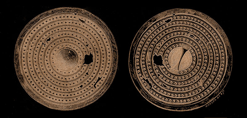
Bronze Objects from Carraig Aille II.
The walls of these massive stone forts were once up to 2.13-m (7-feet) high, each of them topped with a palisade. Carraig Aille II is the more perfect example, and the objects found during its excavation suggest that its residents were the wealthy neighbors of their poor relations in the other fort.
Carrig Aille II has an overall diameter of 47 m (154 ft) and features an unusual entrance—part of it was paved for the residents to use, and another part of it cobbled so that their cattle could join them. There are six sets of steps on the southern wall leading to the rampart. The fort is similar in construction to Cahercommaun in Co. Clare. The structure was occupied from the 8th to the late 10th century.
The most interesting find from the 1937 excavation (by Professor Seán P. Ó Ríordáin) was a hoard of Danish silver, suggesting the presence of—or commerce with—the Vikings. Some of these silver objects were found in a space between two stones in the inner face of the fort’s northern rampart. The other part of the hoard was a single ingot, found about 15 cm (6 in) away in the rubble of the rampart. Ó Ríordáin suggested that this hoard was deliberately hidden “by being thrust in among the stones in the rampart face.”
The Wedge Tomb
“An old woman resided in it for many years and on her death the covering stones were thrown off and it was left in its present state by money diggers who only found some burned bones in an old jug that surely was not worth one brass farthing.” 48
If only today’s archaeologists could have a look at the “old jug” described in the 1833 newspaper article quoted above, they would certainly value it for the information it might hold for them. When Professor Ó Ríordáin excavated there in 1938 by he found the remains of at least eight adults, some fragments of a cremated skull, and four child burials. Radiocarbon tests have determined that the human remains date from around the period c. 2400–1800 BCE. Sherds of both Neolithic and Beaker pottery were also found, as well as part of a mold used to make a spear.49
The tomb, with its VR panorama linked only from the map, consists of a long main chamber and a smaller chamber or portal at the western end. A thick, stone-packed wall runs parallel to both sides of the chambers. After the archaeologists reassembled the tomb, some of its larger stones were set above the chamber to indicate where a cover might have been in antiquity. The tomb measures about 8.8 m (29 ft) by 3.7 m (12 ft).
The most intriguing find from the wedge tomb was discovered about 2 m (6.5 ft) to the south of the structure. When the tomb was excavated the entire skeleton of a young ox was found interred there, with all the bones intact and fully articulated (see photo in gallery below). The position of the skeletal head, which was bent back over the neck, suggests that the ox was sacrificed by having its throat slit while it lay on its side with its legs bound. Carleton Jones observed that the sacrifice of a complete animal, with no consumption of its meat, would have represented an exceptional offering by these Early Bronze Age peoples. ” If this was a votive offering, that is, an offering made with the expectation of some return from the gods, the people were presumably asking for a big favour.”50 An OPW illustration of how a sunset ceremony at the tomb may have appeared can be seen in the gallery below.


Teampall Nua (the New Church)
Our virtual-reality tour of selected monuments at Lough Gur includes Teampall Nua,, linked only from the map. This picturesque ruin shelters the small cemetery that is the final resting place of the lake’s last twentieth-century seanchaí, Tom McNamara. Teampall Nua was so named when the Countess of Bath constructed it in 1679 to replace an even older structure built by the Earls of Desmond. The plain rectangular building is picturesquely situated by the south shore of the lake.51
The Lough Gur Shield.
Working nearby in 1872, two boys discovered what is now known known as the Lough Gur Shield, which “was drawn out of the bog by a boy with a gaff, who, in doing so, broke several holes in the shield, where he struck it with the gaff.52 A replica of this Bronze Age treasure, now in the National Museum, is on display at the Lough Gur Visitor Centre.
Local tradition asserts that the famed Co. Sligo poet-harper Thomas O’Connellan, who was visiting at Bourchiers Castle when he died in 1698, is buried in an unmarked grave here. According to some, the goddess Áine mounted a rock atop Knockadoon and wailed her keening when the poet’s funeral procession passed from the castle to the cemetery.53 Local poet Owen Bresnan, interred here in 1912, composed a song about his seventeenth-century predecessor and the pleasant ruins of Teampall Nua. His words could also apply to our friend Tom McNamara:
“By Lough Gur’s romantic shore,
Where the shamrock and the ivy ever grow;
Where the wild dove and the raven like protecting spirits soar
O’er the green graves of silent Teampall Nua.
O’ sweet Teampall Nua, where our tears so freely flow,
O’er the graves of those who nursed us long ago;
May the heavens smile upon them,
And their choicest gifts bestow
Over the graves of thy loved sleepers, Teampall Nua” 54
Click here to see all the notes from this page.
Lough Gur, Co. Limerick
Nearest Town: Bruff
Townlands: Grange, Holycross, and Lough Gur
Latitude: 52° 31′ 0.46″ N
Longitude: 8° 31′ 40.99″ W