27 Oct Mooghaun Hillfort and
the Great Clare Find
“Why this vast number of gold ornaments should have been collected together and deposited…is a problem to which the present writer feels that he can contribute no explanation sufficiently adequate to exclude other possibilities…Some archaeologists may consider that the ornaments were either:- The spoils of a vanquished people; or a royal tribute; or a votive offering.
It is impossible either to affirm or to deny any of these or other suggestions. The writer does not consider any useful purpose would be served by a long discussion of the subject.”
“The Great Clare Find of 1854,” E.C.R. Armstrong, 1917 1
Click the image above to enter the virtual-reality tour.
Once the palatial residence of the fabled O’Brien family, Dromoland Castle is now a luxury hotel for superstars, presidents, and splurging wannabe oligarchs, with a championship golf course within its forested 538-hectare (1,330-acre) estate.2 The present structure was built by the 4th Baronet Inchiquin in 1835. Some 1.3 km (.8 mi) to the E is the restored tower of an earlier bastion, Mooghaun Castle,3 perhaps projecting as much wealth and political strength in the 15th century as Dromoland was to claim 300 years later.
But another 400 m (437 yds) SW of Mooghaun Castle, and occupying an entire hill with its three massive concentric walls, is Mooghaun Hillfort. This complex and extensive site, the largest of its type in Ireland, was a prehistoric walled village—the bastion of a local king and his extended community of aristocrats and subjects. Mooghaun Hillfort may have represented in the Late Bronze Age a greater political strength and a more significant economic power than either Mooghaun or Dromoland Castles did in their own ages of ascendency.
4,200 Years in the Mooghaun Neighbourhood.
Click for an interactive timeline.
Mooghaun Hillfort encloses within its triple walls an area of more than 11 hectares (27 acres). At the top of its central enclosure it rises 92 m (300 ft) above the plain, and before the recent timber growth offered a strategically important view up the estuaries of both the Shannon and the Fergus, a prehistoric route into the interior of the country. Its ramparts are 6-m (20-ft) thick in places, but, their stones having long since been borrowed for the cashels built much later, do not stand today as tall as they were after their construction around 950 BCE.4 The outermost ring of the fort stretches an astounding 1.37 km (.85 mi) around the perimeter.
About 750 m (820 yds) NE of Mooghaun Hillfort, in March of 1854, workers constructing the Limerick and Ennis Railway were instructed to level a spot near the right-of-way. Thrusting their spades into the sod, they uncovered a rude stone box containing a jumble of twisted metallic objects about 46 cm (18 in) beneath the surface. A few pieces were nonchalantly tossed into the nearby waters before someone breathlessly exclaimed that the dirt-encrusted metal was actually a treasure-trove of gold.
The quartet of lucky railroad workers, or navvies, perhaps with visions of “fairy gold,” ran the 2.4 km {1.5 mi) to Newmarket, where some of the gold was quickly melted down by “barbaric silversmiths.”5

Part of the Mooghaun Hoard of gold ornaments (NMI)
“…one of the parties who filled his hat with the precious metal…sold it to the first who offered in Newmarket, whither he ran with his booty, for £30. The gold is of the purest description consisting of armlets, ringlets, bracelets, collars, &c., and worth £4 per ounce. The lot which the man sold in Newmarket for £30, weighed 110 1/2 ounces, and is valued…at £400.” 6
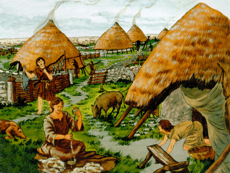
This illustration of a Late Bronze Age domestic scene at Mooghaun Hillfort was created by David Hill for the 1999 booklet he and archaeologist Eoin Grogan produced for the Discovery Programme. See others in the gallery below. Used with permission.
The golden ornaments, perhaps several hundred in number, came to be known as the Mooghaun Hoard or the Great Clare Find.7 Dating from around 800 BCE, this was the largest hoard of Bronze Age gold objects ever found in Western Europe. Most scholars would agree that the treasure trove must be connected in some way to Mooghaun Hillfort.8 How they came to be deposited in this remote spot the author of the 1917 quotation at the top of this page considered a topic unworthy of discussion.
However, in the same spirit in which James McPherson revealed the writings of the ancient Celtic bard Ossian in his poetic “translations” of the 1760s, we will herewith propose three contradictory scenarios, each in the form of a first-person account describing how the Great Clare Find came to be taken from the “Hill of the Three Walls” (Mooghaun Hillfort) and hidden in the spot where it was to be discovered by the lucky navvies in 1854.
Scenario #1: “May it Please the Gods”
The long, great winter has been with us now since the baby was born, and the sad harvest and the hunger have made all of us like old men, even the baby, our eyes sunken into our faces. Yesterday the king summoned us to his lodge at the top of the Hill of the Three Walls. Our priests said that the gods are angry with us and only a great gift to them will bring back the sun, and our full bellies. Today each family was told to bring twenty golden pieces to the king’s wagon, waiting below at the trail to the second loch. We all walked slowly behind the wagon, softly chanting our praise to the god who gives us water, and light, and life. At the lake’s edge the priests had each of us remove our gold pieces from the wagon. They blessed each one of us in turn as we laid our treasures down into a glowing pile at the feet of the head priest. Then we were told to walk back to our homes while the priests completed their prayers and presented the gift to the gods. The priests are wise to the ways of men; now none among us know the spot where our gold was left for the water god.9
Scenario #2: “For Our Children”
Our people know that the fierce ones are coming closer to our homes on the Hill of the Three Walls. We can hear their screaming late at night, as they attack our cousins in the valley and show no mercy. In my father’s time there was no wild tribe that would dare to enter our land. That was before the sickness came, when the gods became angry with us and made our babes weak before their first year. Now there are few young men left to hunt, and fewer still to fight our battles. Our fathers are old men now, and they fear that the great battle is coming soon. Some of us will surely die in the days ahead. But all men must die, and all men must hope. We will hope that our children remember their fathers. We have told them where we buried our gold, inside the stone heap where our grandfathers boiled their meat, close to the loch. And when the battle is over and the fierce ones have moved on, our children will return the treasure back to their homes within the Hill of the Three Walls.10
Scenario #3: “Now it is Ours”
After a three-day journey, finally we saw the Hill of the Three Walls, so close to us that the fires of the old men who live there glowed red in the night sky. There was a time when the warriors from this hill were feared by our fighters, but that time is past. Now we are strong and they are weak. We attacked while they slept, killing their sentries one by one until we found a break in the king’s defenses. We bound the king and his consort, and threatened to kill all the women and children of the Hill unless they told us where their gold treasure was hidden. Amid much wailing, and before the day began to brighten we filled our sacks with 300 fine golden pieces. But our spy in the fort told us that the word had gone out to their allies, and that a large army would be on the march to rescue this king on the next day. With the first light we rushed down from the Hill of the Three Walls with our spoils. We found a hiding place for the gold near the edge of a loch, and there we made a pact to return in a month’s time to reclaim and divide the treasure. But now it will be safer for us if we split up, and we will be wise to have no gold in our purses for a time.11


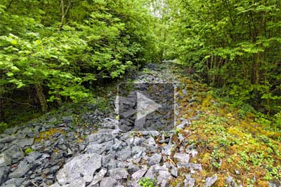
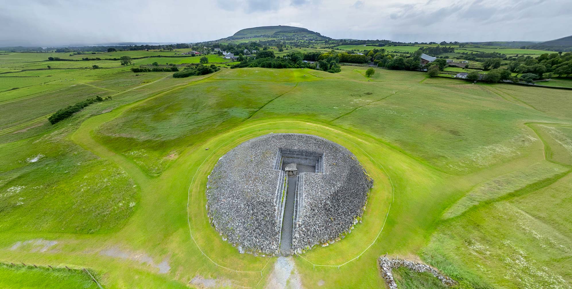
Click to explore one of Mooghaun Hillfort's ramparts in virtual reality.
Mooghaun Hillfort
Called in Irish “Moghane,” the fort’s name in legend is said to have come from a prehistoric warrior who first built the walls as a fighting ring. He was then given a golden cup by his tribe, and took the name “Oircean nagh” (of the golden cap); his descendants became the McInerneys. John Windele (1856) thought that Moghane meant “place of smothering,” deriving from the brutal war practices of its ancient occupants.12 Mooghaun Hillfort projected a political power over an area of more than 450 square kilometers (170 sq mi). There were likely sub-chieftains, each controlling their own smaller territories, but all owing allegiance to the king who inspired the construction of Mooghaun Hillfort.13
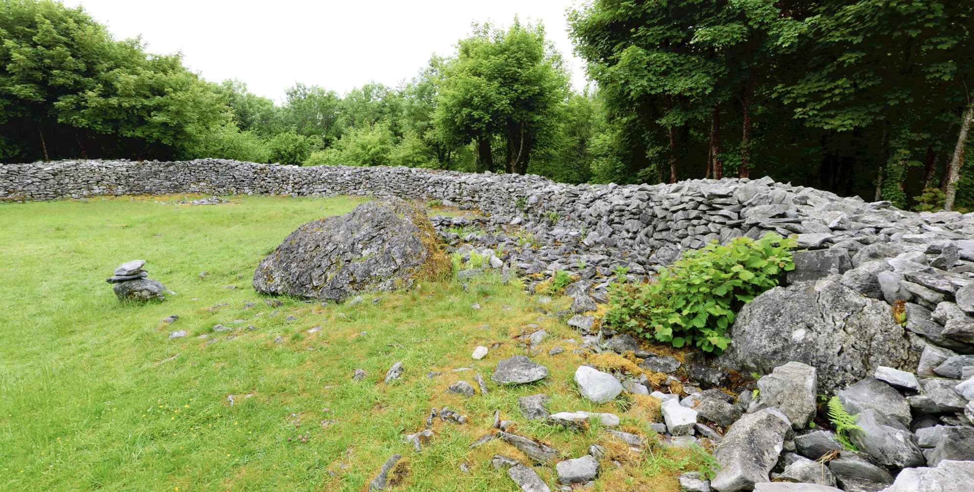
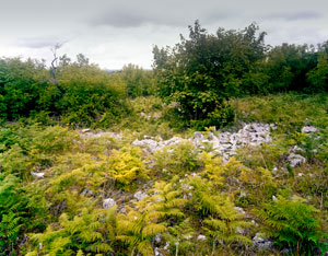
Prior to the modern (1992-1995) excavation, landscaping, and interpretation efforts,14 Mooghaun Hillfort might have seemed to the visitor a confusing jumble of stones, resembling more an overgrown quarry than an ancient regal residence. Three millennia of robbing the ramparts for later construction projects, plus centuries of cattle grazing and intensive agricultural usage had served to obscure the outlines of the fort. T.J. Westropp reported that the local peasants did not in1893 even recognize the lines of stones as being a fort; they thought the the piles were the simply the source of the stones for the construction of Mooghaun and Dromoland Castles.15 The disorganized stones of the ramparts as they appeared in 1979 may be noted in the Zoomify image, below right. It may have been the same scene that inspired Westropp’s poetic observations when he encountered the sprawling ruins:
Struggling through high brakes of ferns alive with birds and rabbits, we wander along masses of fallen stone,…and, standing on the highest summit, look around us…We see in turn the quaint towers of Dromoland it its deep woods, the flashing estuary of the Fergus, the Shannon, the long line of lakes towards Kilkishen, the smoke and high spire of Ennis, the richly-chequered hills of Burren and Aughty, Slieve Bernagh and the Galtees, the Abbeys of Ennis, Quin, and Clare, and the numerous brown, square towers, so old to us yet mere mushrooms of yesterday to the vestiges of human labor that hem us round. Confused by sloe, hawthorns, and undergrowth, it is only on comparing a plan with the fragments that we have a clear idea of the venerable ruins.16
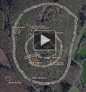
Click for an animated aerial view.
However, around 3,000 years before Westropp’s visit, Mooghaun would have appeared as an imposing clear-cut hillside with gleaming limestone defensive ramparts leading to an impressive ceremonial entrance gate, whose wall was faced with large drystone blocks. A sense of how monumental the fort must have seemed from afar—a symbolic reminder to friend and foe alike—may be gained from the first of David Hill’s illustrations in the gallery above. Because it was the residence of only a small group—just a handful of families—the fort, even with its multiple ramparts, would not have easily been easily defended against a large and determined force. The massive hillfort was more of an architectural expression of power for the dominant social, political, and economic tribal network dominating the area from around 1000 to 750 BCE. According to archaeologist Eoin Grogan, the population of the area may have totaled some 9,000 individuals, and with a construction workforce of perhaps 2250, could have built the massive walls of the fort in about 10 years, motivated by their fealty to the local king and their desire to be involved in a monumental project in which all could take pride. Mooghaun was “…a breath-taking monument demonstrating the power and wealth of the new chiefdom…”17
Click on the image above to see it in high resolution. This image of one of the Mooghaun Hillfort walls was made in 1979, prior to the fort’s excavation and landscaping project (1992-1995).
The Great Clare Find
The central enclosure of the fort, beyond the third rampart at the top of the hill, was probably the most important part of Mooghaun. Here may have been the redoubt of the king and his retinue. And it must have been here where the community gathered for important ceremonial occasions. These events likely drew in people from the entire chiefdom, not only those few families who may have lived in the fort. An Early or Middle Bronze Age cairn located here may have held some ritual or symbolic meaning for the people of Mooghaun, even though it was a remnant of a civilization from a thousand years earlier.18
Perhaps two thousand years after the original construction of Mooghaun Hillfort, long after all memory of the king and his entourage vanished from the hill, a new community came in and made their homes here, using for their building materials the stones from the original hillfort’s ramparts, likely tumbled and overgrown by this point. Three circular drystone cashels, with walls about 2 m (6.5 ft) in height, were built in this fashion, two of them buttressed upon the ramparts of the hillfort, and one constructed just to the SE of the outermost wall. There were also at least five houses. Two of the cashels today are well-preserved, having been repaired and adapted for picnics and other recreational uses by the groundskeepers of Dromoland Castle in the 18th and 19th centuries. The third, the one outside the hillfort’s ramparts, cannot be noted in the satellite view above right, and is evident on the ground only as a circular rocky area. See an illustration of domestic life during this period of cashel-building in the gallery above.19 Near the top of the former hillfort these people, as early as the Iron Age, established a workshop where foundries of iron and bronze were used to fabricate their tools and weapons. Rotary querns were also produced. These cashels seem similar to examples usually dated to the early medieval period, however excavation evidence from the adjacent domestic enclosures indicated a date range of c.1000 – 1300 CE.20
Just as we cannot know the nature of the ceremonial occasions Mooghaun hosted at the height of its powers, we have no way of knowing why or when such a powerful social force dissipated and ultimately saw its commanding ramparts tumbled into a forlorn and fern-enveloped ruin. Was there a change in agricultural fortunes that resulted in starvation? Was the community slaughtered by an competing tribe, or a foreign invader? Could the discovery in 1854 of the fabulous Mooghaun Hoard of golden ornaments less than a kilometer away provide an answer, or several (see above)?
“A stone fell disclosing a sort of box made of rough stones, and a mass of gold ornaments: armlets with dilated or cup-ends, thin gold ‘gorgets,’ and many fibulae; a few ingots of gold were also found.” 21
T.J. Westropp, 1918
“We were gratified on Monday with an inspection of some of the largest, most valuable and beautiful of the Irish ornaments recently discovered near Newmarket-on-Fergus, and now in possession of Mr. William Halpin, the respectable shopkeeper of that place, They were discovered, with many more, by four labourers named Gregan, Haneen, Corkoran, and another…” 22
Collectianea Antiqua, 1854 (from The Munster News)
Also known as the Mooghaun Hoard, the Great Clare Find was simultaneously a uniquely fabulous archaeological discovery—perhaps 300 pieces of ornamental gold objects from the Late Bronze Age—and a sad example of opportunism resulting in an irreparable loss to Ireland’s patrimony. Although the hoard was likely the largest ever found in Europe, all but around 34 pieces were destined to be melted for their bullion value, with gilt-bronze casts made of some of the pieces prior to their destruction.23
The four railroad workers who discovered the gold were reported to have eventually garnered some £6,000 for their day’s booty. This would have been a royal fortune for the men: presuming they divided the gold equally, each of them would suddenly have been enriched by £1,500 during an era when their daily pay was only 1s 10p (less than one-tenth of a pound sterling). Therefore, on that one Thursday in 1854 they would have each had their fortunes enhanced by the equivalent of more than 52 years’ salary. In Newmarket that evening the Guinness must have been flowing freely.24
Three months later an exhibit of 146 pieces, weighing more than 5 kilos (11 lbs), was arranged for the members of the Royal Irish Academy. Due to the asking price the Academy was able to purchase but 12 pieces, which included five collars and two neck-rings. The British Museum purchased 14 of the ornaments for its collection: a collar and thirteen bracelets. Afterwards the remaining objects were dispersed, with most of the pieces consigned to the smelting pot, never to be seen again.25
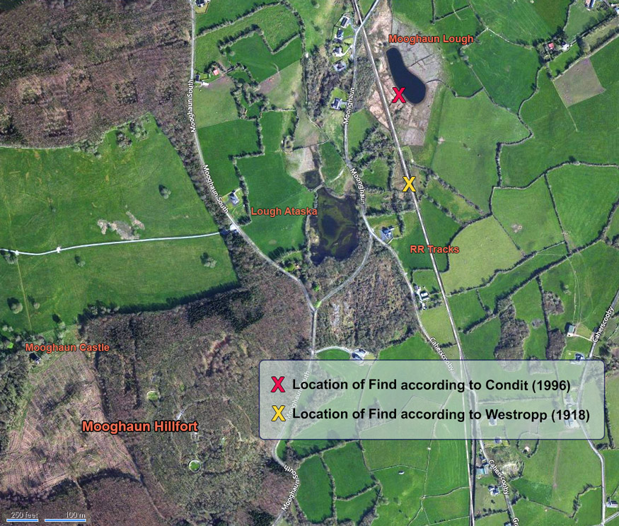
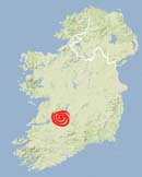
Click to see where Westropp (1918) and Condit (1996) placed the Great Clare Find. (Bing Map)
As may be seen in the annotated satellite map (left) there is some confusion regarding where the Great Clare Find was actually located. In 1908 and again a decade later T.J. Westropp attempted to pinpoint the location, using a close reading of the contemporary reports, and his own on-site interviews with the descendants of some of the principals. He was vexed in his initial inquiries, as there still remained a remnant of fear from those who profited from the find that someone more powerful would use legal means to remove them from their riches.26 But in 1918 he triangulated his findings and came to the conclusion that “the true site lay under the railway almost exactly 1,400 feet south of Moghane Railway Bridge.” This is where we placed the yellow “X” in the map.27
Some 80 years later, Tom Condit, writing in Archaeology Ireland, focused upon other evidence, and suggested a different spot entirely. Because two of the contemporary reports suggested a connection with “open air cooking places of our ancestors,” and because one newspaper account seemed to have misidentified the name of the lake closest to the find, Condit pinpointed a particular degraded fulacht fiadh (cook site) on the SW shore of Mooghaun Loch as the spot where the gold was secreted. This where we placed the red “X” in the map.28
Neither of the “X” spots on our map fully supports the view that the Mooghaun Hoard was a votive offering thrown into a body of water, intended to appease or honor a supernatural entity, and never intended to be recovered. It is known that the level of Mooghaun Lough was considerably higher before an early 20th-century drainage project, thus making it possible that the construction of the railway in 1854 took it through land that was submerged during the Late Bronze Age. However, the placement of the hoard inside a stone box might have been difficult to accomplish under the surface of the water. Furthermore why would these valuable objects be placed into a prominent repository, where they could be easily recovered, if the intent was to send them off into the supernatural? Elsewhere in Ireland, it is widely accepted that the artificial pool called The King’s Stables, near Navan in Co. Armagh, was created by a water cult for the ritual deposit of votive objects.
The total number of objects known to survive from the Mooghaun Hoard was in 1997 increased by one when a visitor at the National Museum of Ireland, after studying the gold ornaments in the display case, mentioned to an official that a friend of hers had a bracelet from the Hoard, kept in the family for generations, regularly polished, and worn as jewelry. The piece was acquired by the Museum and is now on display. In the gallery below you can compare this bracelet with a naturally tarnished gold collar from the Hoard, now in the collection of the British Museum. There were other bracelets mentioned in the historical record as being in the possession of the Inichiquins of Dromoland Castle. While most of these are now apparently lost, it seems that two Mooghaun bracelets were buried with their owner.29 Will an archaeologist in the distant future see this as an opportunity for excavation?
And…just in case any of our readers think that they might wish to assimilate the information on this page and then go off on their own private quest for treasure buried in the vincity of Mooghaun Hillfort, let us offer some important cautions. First, it is very likely that within days of the Great Clare Find in March of 1854 the hills, fields, and bogs within miles of the discovery were crawling with men, shovels to the shoulder, who left no stone unturned in an effort to replicate the fortune of the four navvies.30 In today’s Ireland, unless you have a license to do so, it is an offence to dig for archaeological objects. Using a metal detector to search for such objects (very broadly defined) is also illegal, as is even the possession of a metal detector within any of the 130,000 protected sites in the Republic. “Such usage is subject to severe penalties, including imprisonment and/or fines.” There are similar prohibitions in Northern Ireland. And, if you are still not dissuaded from your hunt for fairy gold, you should be forewarned that most of those who found the Mooghaun Hoard, according to local folklore, ultimately met with the fairies’ disfavor and “did not profit by it; [and] the one lucky exception did not find his prosperity permanent.”31


Click here to see all the notes from this page.
Mooghaun Hillfort, Co. Clare
Nearest Town: Newmarket-on-Fergus
Townland: Mooghaun South
On the grounds of Dromoland Castle
Latitude: 52° 46′ 58.8″ N
Longitude: 8° 52′ 44.4″ W