
30 Oct Rathcroghan Royal Site
“We Irish should keep these personages much in our hearts, for they lived in the places where we ride and go marketing, and sometimes they have met one another on the hills that cast their shadows upon our doors at evening…When I was a child I had only to climb the hill behind the house to see long, blue, ragged hills flowing along the southern horizon. What beauty was lost to me, what depth of emotion is still perhaps lacking in me, because nobody told me…that Crúachan of the Enchantments lay behind those long, blue, ragged hills.”
W. B. Yeats, Cúchulainn of Muirthemne, 19021
“Despite the difficulty, if not the impossibility, of firmly correlating specific monuments with sites mentioned in early tales, the general legendary associations of Rathcroghan and its rich mythology now, as in the past, imbue the land with magic…”
John Waddell, Rathcroghan: Archaeological and Geophysical Survey in a Ritual Landscape. 20092
Drag within the image to explore an 18-node virtual reality tour of the Rathcroghan monuments,
beginning at the main mound of Rath Crúachan.
An interactive map will appear when you click the button to enter full-screen mode.
Some locations are accessible only from the map. Touch here for the mobile version.
Rathcroghan (the Fort of Crúachan)3 has both a geographic and a symbolic presence. It is an archaeological treasure trove, a 1,000 ha (four square mile) collection of some 60 different monuments, including an immense ceremonial mound, a haunted cave, and a holy well. But it also exists on a metaphysical plane, the venue of a queen-goddess with the power of conferring legitimacy on the tribal kings of ancient Ireland in an inauguration ritual lost to time.
Located in several townlands around the village of Tulsk in Co. Roscommon, the earthworks of Rathcroghan and Carnfree, prominent protuberances on the gently rolling landscape, have attracted the attention of investigators since 1753, when Charles O’Conor called the area “…Drum Druid, famous for its great Cave and Druidic Rites, a Place which, long before Ptolemy’s Time, got the name of Crúachan, where the States of Connaught assembled…”4 As the studies of ancient monuments evolved from the primitive efforts of antiquarians to the methodical investigations of modern archaeologists, the tools have changed considerably. The Discovery Programme began its modern survey work in the area in 2005. In 2007 and 2008, Professor John Waddell and his team used “archaeological geophysics” to explore some of the monuments in great detail.5 Dr. Waddell’s work at Rathcroghan and nearby sites continues.
Although the mounds likely date from the Bronze Age, thousands of years earlier than the Iron Age fiefdoms of Ireland, tradition considers this the inauguration site of the Kings of Connacht.6 Crúachan was most famously the home of Ailill, King of Connacht due to his marriage to the quasi-divine Queen Medb, the cunning antagonist of the Ulster hero Cúchulainn in the Táin (Táin Bó Cúailnge, The Cattle Raid of Cooley).

Rath Craughan or Croghan. Gabriel Beranger, watercolor, 1779. A transcription of its text may be found at the end of the citations.
Many of the early references to Crúachan present vivid descriptions of Iron Age courtly life, all impossible to verify, such as in an 8th-century text where the bed of the king is described as having a bronze headboard with “carved red yew all covered with fair varied ornament.”7 But these same sources provide us with no information whatsoever regarding the physical remains of today, the earthen monuments we know as Rathcroghan. While the early stories of Crúachan may not actually provide us with, as Kenneth Jackson suggested in 1964, “a window on the Iron Age,”8 we may yet be able to distill from these lush descriptions a sense of the prehistoric warrior culture they depict.
Even more tantalizing than the “window” presented by literature may be the stone inscription discovered in a fabled Rathcroghan cave. The man-made souterrain entrance to Oweynagat Cave, perhaps medieval in origin, uses as its lintel stone what may be a prehistoric grave marker. It contains the ogham inscription ” VRACCI MAQI MEDVVI, which has been translated as “Fráech, son of Medb.”9 Is it possible that the lintel may be engraved-in-stone evidence that the legendary Medb once actually ruled the province of Connacht from this royal site? The significance of this ogham stone is discussed below in the sections on Oweynagat Cave and Carnfree, both of which may be visited in the virtual-reality tour of Rathcroghan.
This VR environment (top) begins at the foot of the great mound of Rath Crúachan. Using links within the scene and others in the map that appears when the tour is viewed in full-screen mode, you can navigate to Clochfadha, Dathi’s Stone, Carnfree, Carn Lamá, the Ogulla Holy Well, Misgaun Meva, Milleen Meva, Oweynagat Cave, Rathbeag, Rathmore, Rathnadarve, and Relig na Rí. A satellite view with the monuments indicated may be seen here.
“[The monuments] proclaimed the relationship of the community to land and ancestors and probably served as mnemonic devices for remembering the past and for structuring oral history…We may be reasonably sure they were points of reference in both a ritual and a mythological landscape in which territorial and genealogical rights were expressed in both monument and oral tradition.”
10
Rathcroghan Mound
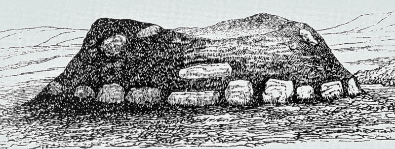
The Rathcroghan Mound (Rath Crúachan) is the largest and most accessible of the Crúachan sites. Just off the N5, it is the only one of the sites with its own large parking area, and features an information sign about the Táin. It is a site of prodigious proportions: 89 m (291 ft) is its average diameter, with a height of around 5.5 m (18 ft). As large as this is, it was surrounded by a much larger ancient earthen enclosure, now obscured, with an astounding diameter of 360 m (1,181 ft). Once thought likely to contain a passage tomb, the modern techniques of archaeological geophysics have revealed no evidence of such an interior structure.11 Rather the investigators, while reporting “a perplexing complexity”12 of underground features, concluded that it was a ritual site where the mound seen today covers and entombs earlier structures, including a large circular platform on the summit. This feature may be noted in the 1779 Beranger watercolor (above, right), and in the magnetic gradiometry image (below left). There are also shallow depressions that divide the top of the mound into segments. The mound may conceal the remains of inner concentric walls deep within its interior, as well as timber structures that were subsequently buried in the mound.
The magnetic gradiometry image (below, left) shows evidence of pits and ditches, which may have functioned as palisade trenches. In this image the great mound, the one feature easily noted by today’s visitors, is in the center. The vast enclosure is the distinct circle at the outer edge of the image. What may be a ceremonial avenue, trapezoidal in shape, leads to the mound from the east. Within this avenue two burial mounds may be seen. Just above the great mound, at the one o’clock position, is the more faint indication of a small circular enclosure with its own eastern avenue. A double circle of pits, barely visible, may evidence of a large timber structure that stood atop the mound, where it would have presented an inspiring sight, elevated above the horizon.13 Other features may be hidden under the paved parking area, perhaps to be explored by a new generation of archaeologists with a new generation of imaging tools. After his geophysical investigations, Waddell observed:
“Despite Rathcroghan Mound’s deceptively plain external appearance, the results of this research have revealed a wealth of previously unknown and unexpectedly large and complex archaeological features on its summit and also deep within its core…It is now apparent that the great mound was both the focal monument of the entire Rathcroghan complex and the centrepiece within the large enclosure.” 14
The information sheet provided by the Cruachan Aí center in nearby Tulsk is much less hesitant than the archaeologists to add a human dimension to the geophysical findings, claiming that the structure that once stood on top of the mound was “for use in Druidic worship as well as festivals and the coronations of the kings and queens of Connacht. Fairs and games were held on the ‘lawns’ of Crúachan for over 1000 years between 500 BC and the coming of Christianity around 500 AD.”15
Much of the early literature refers to Crúachan as both a sacred cemetery and a royal settlement. In the 8th-century Tain Bo Fraich (The Cattle Raid of Fraoch), the palace of King Ailill and Queen Medb at Crúachan is desribed in shimmering detail:
“This was the arrangement of the house: seven partitions in it, seven beds from the fire to the wall in the house all around. There was a fronting of bronze on each bed, carved red yew all covered with fair varied ornament. …There were sixteen windows in it, and a shutter of copper for each of them. There was a lattice of copper across the skylight. Four pillars of copper were over the bed of Ailill and Medb which stood in the middle of the house all adorned with bronze. Two borders of gilded silver were around it. A silver stave reached from the border to the cross-beams of the house.” 16
Misgaun Meva and Milleen Meva

Rathcroghan Mound: magnetic gradiometry image. (John Waddell, 2014. Used with permission.)
A fallen 2.9 m (9.5 ft) pillar-stone to the north-west of the Rath Crúachan mound has been called Misgaun Meva, “the lump (of rock) of Méabh,” and is said by some to mark the location of the mythical Queen Medb’s burial. This stone may be accessed in the virtual-reality tour from hotspots placed in the VR nodes below and on the top of Rath Crúachan.
Oweynagat Cave 3D Model by The Discovery Programme
It is known locally as “Medb’s Butter.” This stone, together with another nearby prostrate stone called Milleen Meva, “the small lump (of rock) of Méabh,“ but also known as “Medb’s Cheese”, form an entrance avenue to Rath Crúachan through which, according to one early 10th century antiquarian, all future rulers of Connaught entering the royal site were required to pass.17 While the name of the fallen pillar evokes the legend of Medb’s palace here at Rathcroghan, the immense stone cairn of Knocknarea in Co. Sligo is more often regarded in folklore as the tomb of the legendary Queen Medb.
Oweynagat Cave (Cave of the Cats)
The underground feature traditionally called Oweynagat (“Cave of the Cats”) is actually a natural limestone fissure in the earth, with a (perhaps medieval) souterrain serving as its low, barely noticeable entrance. Using the interactive 3D model (above right) you can visualize the full extent of the cave. In our virtual-reality view (top left) only the entrance souterrain is explored. An 1886 text credits the feline connection with the fact that wild cats would hunt the rabbits living inside. In the 10th-century tale “Bricriu’s Feast,” however, three heroes of Ireland are tested in the cave by monstrous cats.
“One night as their portion was assigned to them, three cats from the cave of Crúachan were let loose to attack them, that is, three beasts of magic. Conall and Loegaire made for the rafters, leaving their food with the beasts. In that wise they slept until the morrow. Cúchulainn fled not from the beast which was attacking him. When it stretched its neck out for eating, Cúchulainn gave a blow with a sword on the beast’s head, but the blade glided off as it were from stone.” 18
In one of the prologues (remscéla) of the Táin, the cave was considered to be the treasury house of Queen Medb; this tradition prompted the nearby farmers to search, always in vain, for the treasure of Medb and Ailill.19 The cave acquired the reputation in the early days of Christianity in the country as “Ireland’s Gate to Hell.” Another name for it is “Hellsmouth Cave,” perhaps because, according to the prevailing pagan belief, it was the local entrance to the realm of the fairies.20 In the Dindshenchas (Place-Name Stories) the cave was the home of the Morrigan, the Celtic goddess of war and destruction. Other animals, such as evil birds, werewolves, and pigs, were also associated with the site.
“A herd of magical swine came to Ailill and Medb out of the Cave of Cruachu, and they used to blight corn and milk wheresoever they were, nor could the men of Erin in any place count them or look them over. So to set their hunt afoot Ailill and Medb came to Fraechmag ‘Heatherfield,’ and chased the swine as far as Belach na Fert ‘the Pass of the Graves,’ and there Medb caught one of them by the leg; but it left its skin in her hand…”21
The legendary association with animals may be the inspiration for the story of a woman who chased her calf into the cave. The animal then dragged the unfortunate soul all the way to the Caves of Kesh, some 40 km (25 mi) distant. As a visualization of this legend, there is a hotspot in the virtual-reality panorama of Oweynagat Cave that will link to the Caves of Kesh.22 The Oweynagat Cave environment of today has been altered from that visited by the early antiquarians due to a modern lane that bisects the land above cave, where previously a circular enclosure could be discerned. The visitor today will find a short, 3 m (10 ft) souterrain leading to a mostly natural, rather muddy and narrow cave passage of some 47 m (154 ft). The visitor must crawl in for some 10 m (33 ft) before there is room enough to stand. A much more visitor-friendly souterrain may be visited at Binder’s Cove, in Co. Down.
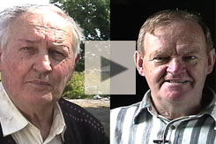
Tom Farrell remembers searching for lost sheep in the Oweynagat Cave; Martin Mitchell talks about a trick played on a young Tom Farrell (1998).
Among the wealth of mythology associated with the cave, perhaps the most harrowing and surreal story is that of “The Adventure of Nera” (Echtra Nerai), when the royal couple at Cruachain, Ailill and Medb, were celebrating the festival of Samhain, the precursor of Halloween. The warrior Nera goes outside the palace and discovers a captive who had been hanged the previous day, still alive and complaining of thirst. Nera cuts down the hanged man, gives him a drink and then carries him back to resume his torture. But upon returning to the celebration he finds that the people of the sidhe (fairy world) have burnt the palace and left a pile of heads. Nera follows them into the cave and finds that he now has a home and a wife within. The woman explains to him what he has witnessed was a vision of what would actually befall Cruachain unless its inhabitants are warned. When he asks her how he could possibly convince the king that he has been in the sidhe, she tells him “to bring the fruits of summer to the winter world outside”:
“‘Bring the fruits of summer with you,’ said the woman. So he brought wild garlic with him, and primroses and buttercups…
He leaves the Otherworld to warn Ailill and Medb, who eventually destroy the sidhe…but ‘Nera was left in the sidhe together with his people, and has not come out yet, and he will not come out until the end of the world.'” 23
Perhaps the most compelling archaeological detail of Oweynagat Cave is found on one of the lintel stones supporting the walls of the souterrain at the cave’s entrance. This may be viewed by clicking on a hotspot in the VR tour. Samuel Ferguson, exploring the cave in 1864, discovered the ogham writing on the stone that he translated as “Fráech, son of Medb.”24 Fráech, the hero of another “cattle-raid” story, the Táin Bó Fráech, was Queen Medb’s son-in-law, married to her daughter, Finnabair. Is it possible that this ogham stone, re-used to construct a souterrain perhaps thousands of years after the first builders of the Rathcroghan Mound lived, provides evidence of the Royal Crúachan of Medb and Ailill? Or was the ogham stone custom-inscribed to provide a sense of sanctity to the construction of the souterrain tunnel in the early medieval years?25
Dathi’s Stone
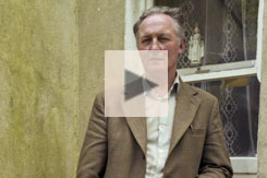
In a 1979 interview, local farmer Tom Farrell made it clear that the land around Dathi’s Stone was considered an enchanted place.
“It’s called the ‘Long Stone,’ and there’s no other stone in this area like it. This is a limestone area, but that is a brown stone; it reminds you of an emery stone. Lots and lots of tourists has taken little chips of it away with them because they’ve never seen anything like it. It’s about seven feet tall and there’s supposed to be that much underground.” 26
Farrell went on to describe how a group of men walking by this curious brown stone became “lifted,” disoriented. “They were walking for hours and hours on paths they knew well, but they couldn’t find their way.” (See video, below right.)
Dathi’s Stone got its name from the last pagan king of Ireland, a legendary character of dubious historical existence, who, in a 17th-century story,27 was supposed to be interred beneath a red pillar. In both modern and antiquarian excavations however, no evidence of a burial was to be found. After Samuel Ferguson visited the stone in 1872, he became so enchanted by the story of King Dathi’s supposed military battles on the Continent, and the hero’s death by a bolt of lightning in the Swiss Alps in 428 CE, that he traveled to Switzerland in an attempt to retrace the supposed steps of the monarch. O’Donovan however, visiting the stone in 1837, admitted, “tradition at present has no recollection of it marking the grave of Dathi.”28 Dr. Waddell calls the story of Dathi “a characteristic farrago of the etymological ingenuities and misplaced learning of the medieval antiquaries.”29 Whatever the truth of the matter, such legendary associations have served to draw attention to Rathcroghan from the 19th century to the present day, and thus have had a role in its preservation. An ancient elegiac poem, quoted in 1873, commemorates the stone:
“There lied under thee the King of the men of Inis Fail
Dathi the son of Fiachra the triumphant,
O Crúachan , which doth this conceal
From foreigners and from the Gaedhils!” 30

Tomb of Dathi. William Wakeman, 1903
Carn Lamá
Formerly known as Dumna Selga, this mound, technically a “bowl barrow,” traditionally was where the severed hand of the warrior Fráech was buried after he was drowned and then decapitated during his single combat with Cúchulainn during the Táin Bó Cúailnge.
The Dindsenchas (“Place Name Tales”) recounts the naming of Duma Selga (“the Mound of the Hunt”) It seems that it was the burial spot for the decapitated heads of some enchanted pigs, originally children transformed into swine. The unfortunate piglets were sadly spotted by a hungry Medb who, unaware of their human provenance, caught and killed them. The leftover heads were then buried in the mound.31
Clochfadha
Known in Irish as Cloch Fhada na gCarn (“The Long Stone of the Cairns”), this limestone pillar at Carnfree is 3.2 m (10.5 ft) high and .5 m (1.6 ft) wide. It is nearly centered inside a circular ring barrow with a diamter of roughly 35 m (115 ft). Some 15 m (49 ft) to the SE of this stone is a larger, though prostrate stone that is 3.6 m (11.8 ft) long.32
Carnfree
Known as the inauguration site where kingship rituals for the Christian O’Conor leaders were performed, this small mound was also in legend the burial spot of Fráech, Medb’s son-in-law.
Carnfree, by William Wilde, 1880
Some sources suggest that Medb’s daughter, Finnabair, also lies within the mound.33 The Proclamation Stone of the O’Conor clan once stood atop the mound and was used until 1641 in a ritual in which a newly elected king was required to step into the marks reputedly left on the stone by the Connachta ancestor, Conn of the Hundred Battles. This ritual, from early historic times, may have originated from the reverence accorded the site in antiquity, with the goal of projecting that reverence into the political sphere. The stone, as seen in the photograph below right, has been removed and is now at Clonalis House near Castlerea.
“A grander spot, or a more enchanting view, could not be obtained by a King of Ireland as he stood on the inauguration Carn, with his face to the north, his feet on the Sacred Stone, and amidst the shouts of thousands was handed the white wand of Sovereignty.” 34
Some have suggested that when the O’Conor inauguration stone was placed on the mound the burial marker for Fráech was removed, and then re-used as the lintel stone in Oweynagat Cave, with its ogham inscription added in the fifth century.35
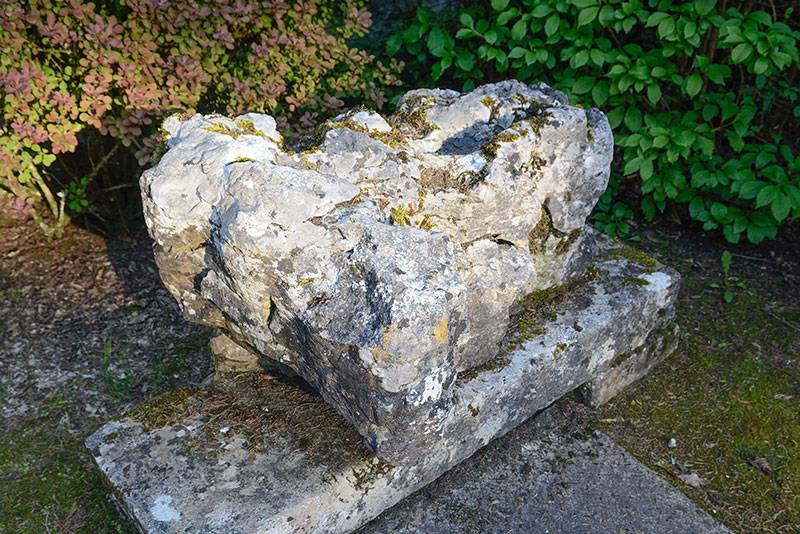
The O’Conor Inauguration Stone was formerly located atop Carnfree. It is now at Clonalis House.
(J. Mason, Heritage Planning and Design Services)
Rathmore
The large mound, a raised ring fort, is located just off the N5. It is believed to have been built during the late first millennium CE, perhaps as a high-status habitation site of an important regional family, or as an Iron Age communal hall.
Remnants of postholes may be evidence of a large circular building that once stood at the summit of the mound. This site was extensively documented by geophysical imaging technologies, which indicated anomalies in the interior, with no visible surface indication, suggesting pits, hearths, and ovens.36
Rathnadarve
Rath na dTarbh,”The Fort of the Bulls” (see the conclusion of the Táin, below), was where the two legendary bulls, the Donn Cuailnge of the Ulstermen and the white-horned Finnbennach of Connacht, fought their final bloody battle. The Rathnadarve enclosure provides a symmetrical geographical ending to the epic, which begins nearby with the king and queen’s “pillow-talk” at their palace of Crúachan.
“The Donn Cuailnge was brought to Connacht. When he saw this strange and beautiful new land he let three great bellows out of him. Finnbennach, the White-horned Bull, heard him. On account of Finnbennach no male beast on the Plain of Ai dared raise a sound louder than a moo. He threw up his head and proceeded to Crúachan to seek out the Brown Bull.” 37
The site seems to archaeologists to be a habitation site, with now-obscured remains of a number of hut sites. It has a cobbled entrance connecting to an ancient trackway on the side opposite the modern road.
Ogulla Holy Well
This was the scene, in local legend, where pagan and Christian traditions first encountered one another. See the well in virtual reality here. The pagans lost, the story goes, but in losing they won eternal life. This well, the nearby “rag tree,” and the chapel brought here after its use in hosting Pope John Paul II at Knock in 1989, all stem from a story from Tirechan’s Life of St. Patrick from the Book of Armagh. In this tale the two daughters of the pagan king Lóegaire, Eithne and Fidelma, asked to meet St. Patrick here in 432.
“But then St. Patrick came to the well which is called Clebach, on the slopes of, and to the east of, Cruachain, before sunrise, and they sat beside the well. And behold, the two daughters of King Laoghaire, Eithne the fair, and Fidelma the ruddy, came to the well, as women did, for morning ablution, and they found a holy synod of bishops with Patrick at the well.” 38
They were, it was said, so taken by his explanations of the Christian god and the hereafter that they were allowed to die and enter heaven immediately following their baptism. The two women were buried “beside the spring of Clébach,” which many have identified as this spot.
Relig na Rí
These earthworks were considered to be the “Cemetary of the Kings” since the 18th century. Although no evidence of any burials were ever discovered here, William Wakeman in 1886 confidently proclaimed it to be the site of Queen Medb’s mortal remains.39 This is a circular enclosure 100 m (328 ft) in diameter, surrounded by a stony bank. Inside is found a souterrain (linked in the VR tour), evidence of at least three rectangular houses, and the remains of a smaller circular enclosure. Relig na Rí may actually be the remains of a settlement of the early historic period. In folklore its inner area is said to be divided into sections corresponding to an ancient map of Ireland.40
Rathbeag
The burial mound known as Rathbeag, is not really a rath (fort) at all, but an Iron Age ring-barrow burial situated atop a natural rise in the earth. There are two earthen banks set around the central barrow, giving the mound a stepped appearance.41
The History of Rathcroghan
“A person standing on the great focal mound in that complex in later prehistoric times would have had a view of a landscape saturated with meaning. More than twenty-five burial mounds would have been visible from this vantage point and were testimony to the funerary importance and sanctity of the place as a whole in later prehistory.” 42
William Wilde in 1852 thought Rathcroghan so significant in Irish prehistory that he labeled it “the Tara of the west.”43 In texts from the 14th to the 19th centuries Rathcroghan is mentioned as one of the four major royal sites in ancient Ireland, alongside Tara (Co. Meath), Navan Fort (Co. Armagh), and Knockaulin (Co. Kildare). In the 9th-century text of the Triads of Ireland, Rathcroghan was noted for its oenach, a ritual assembly or fair:
“The three fairs of Ireland:
The fair of Teltown, the fair of Crúachan, the fair of Colman Elo.” 44
In the late 12th century a section of the Book of the Dun Cow, the oldest surviving Irish manuscript, lists Crúachan as one of the chief cemeteries of ancient Ireland. Here and elsewhere the site is considered both as a place of burial and as a location for ritual assemblies. In legend, after a king took for his wife a woman who was descended from the mystical Tuatha de Danann, the kings were thereafter buried at Newgrange (Brú na Bóinne).
“Fifty mounds, I certify,
Are at Oenach na Cruachna,
There are under each mound of them
Fifty truly-fine warlike men.The three cemeteries of Idolaters are
The cemetery of Tailten, the select,
The cemetery of the ever-fair Crúachan,
And the cemetery of Brugh.” 45
A younger Tom Farrell recalls when his uncles became lost when crossing the fields near one of the Rathcroghan monuments (1979).
The Rathcroghan and Carnfree complex has been described as a “ritual landscape,”46 But the forms of the rituals that transpired there must remain unknowable, rituals that continued and evolved over a period of thousands of years. Dr. Waddell suggests that even after the coming of Christianity to Ireland Rathcroghan would have presented to the pagan pilgrim a landscape with symbolic connections to both his mythical and his historical ancestors.
“In the burial mounds and associated myths at Rathcroghan we glimpse some of the elements that formed a part of that continual process of creation of a mythical landscape in which myth restated and confirmed claims to ancestral lands, kinship, power and social status.” 47
One suggestion regarding the ritual performed at Rathcroghan, based upon what Giraldus Cambrensis observed at an Irish site in the 12th century, was that it involved the drinking of alcohol and the ensuing mead-influenced blood-letting of a sacrificial horse.48 If this is so, it is likely no accident that the mythical figure most associated with Royal Crúachan is the intoxicating Queen Medb, the personification of sovereignty. Any man who would to be king must consummate his ambition by performing a symbolic union with the woman whose very name can be translated as “She who makes men drunk.”49
“A beautiful, pale, long-faced woman, with long flowing golden-yellow hair upon her, a crimson cloak, fastened with a brooch of gold over her breast; a straight-ridged slech, or light spear, blazing red in her hand.” 50
Queen Medb, or Maeve, ruled Connacht from her mythical palace at Rathcroghan, supposedly around the time of Christ. She was both the Queen and the military leader, a role that we will explore a bit later. She was also a Celtic archetype of ecstatic appetite, especially noted for her prodigious amorous accomplishments. On more than one occasion she offered to sweeten a deal by including the inducement of her “friendly thighs.”51 Medb had numerous husbands, including Conchobar, the king of the Ulstermen against whom she would ultimately make her most notorious battle. As Dr. Waddell phrased it, “To gain possession of Medb of Cruachain was to gain possession of the kingship…”52 And from Medb’s own words in the Táin:
“I asked a harder wedding gift than any woman ever asked before from a man in Ireland —the absence of meanness and jealousy and fear…If I married a jealous man that would be wrong. I never had one man without another waiting in his shadow.” 53
The Táin Bó Cúailnge begins with a section called “The Pillow-Talk,” in which Queen Medb and her husband King Ailill, at their palace at Rathcroghan, lie in bed and compare their respective fortunes.
“One night when the royal bed had been prepared for Ailill and Medb in Crúachan Fort in Connacht, they engaged in pillow-talk:
‘It’s true what they say, girl,’ said Ailill. ‘Well-off woman, wealthy man’s wife.’
‘True enough,’ said the woman. ‘What makes you say it?’
‘Just this,’ said Ailill, ‘that you’re better off now than the day I took you.’
‘I was well-off before it,’ said Medb.
‘If you were, I never heard tell of it,’ said Ailill, ‘apart from your woman’s assets that your neighbour enemies kept plundering and raiding.'” 54

Queen Maeve. J.C. Leyendecker, 1907
Medb and Ailill then compare their assets, and soon discover that they are equal in all possessions, save for one: the King’s magnificent white-horned bull, Finnbhennach, who had previously decided to abandon Medb’s herd and join that of her husband. Thus Medb determines that she must posses a bull that is even greater than Finnbhennach: a bull in the province of Ulster called Donn Cuailnge, the Brown Bull of Cooley. After she fails to acquire Donn Cuailnge using her charms (including the promise of her “friendly thighs”) she makes war on the Ulstermen to capture the fabulous bull. The warriors of Ulster, unable to fight due to a curse laid on them,55 rely on their supernatural hero Cúchulainn to fight all the battles against the Connacht forces of Queen Medb. In a series of vividly described encounters at various fords, using both single-combat and chariot-fighting, Cúchulainn holds off the Connachtmen until his Ulster compatriots recover their strength and are able to join the battle. In a final epic struggle, Medb and her Connacht forces are defeated. Cúchulainn later would meet his own tragic demise.
“Medb said to Fergus: ‘We have had shame and shambles here today, Fergus.’ ‘We followed the rump of a misguiding woman,’ Fergus said. ‘It is the usual thing for a herd led by a mare to be strayed and destroyed.'” 56
Although defeated, Medb manages to bring the Brown Bull of Cooley back home to Crúachan, where, in an enclosure now known as Rathnadarve (The Fort of the Bulls, a link in the VR environment) begins the horrific final act, the battle between the two great bulls, Donn Cuailnge and Finnbhennach. “Everyone who had escaped the battle stopped what he was doing, to see the two bulls fight together.”57
“…the bull jerked back his hoof. His leg broke, but the other bull’s horn was sent flying to the mountain nearby. It is called Sliab nAdarca, the Mountain of the Horn, ever since. Then the bulls fought each other for a long time. Night fell upon the men of Ireland and they could only hear the uproar and fury in the darkness. That night the bulls circled the whole of Ireland. When morning came, the men of Ireland saw the Donn Cuailnge coming westward past Crúachan with the mangled remains of Finnbennach hanging from his horns.” 58

The Death of Dathi at the Foot of the Alps, in A.M. Sullivan’s The Story of Ireland, 1867.
But the great Brown Bull of Cooley is himself mortally wounded, and wanders around Ireland, pieces of Finnbhennach’s flesh falling off his horns. Creating place-names as he traverses the countryside, he finally returns home to Ulster. There, in a final blazing fury, he slaughters some of its inhabitants before collapsing and dying.
The oldest, though incomplete, version of the Táin Bó Cúailnge—from the 12th century—is found in the Book of the Dun Cow. Other pieces of the story come from the late-14th-century Yellow Book of Lecan. Scholars suspect, from a linguistic analysis, that the earliest form of the story may date to the 8th century. Some passages may be two centuries older than that, with a long oral tradition before being committed to parchment.59
For the early antiquarians the details of Rathcroghan presented in the Táin and in other medieval texts were accepted as historical fact. Indeed, in the mapping of and naming of some of the Rathcroghan monuments, such scholars as Charles O’Conor and later John O’Donovan followed closely the heroic annals. Today, however, the stories of the Táin have been put into a different, less literal and more literary perspective. And Medb, Ailill, and Cúchulainn have made a successful transition from historical figures to symbolic archetypes.60
Even the 12th-century monk who copied the Táin into the Book of Leinster must have had his doubts. He added his postscript, in Latin:
“But I, who have written down this story, or rather this fable, give no credence to the story, or fable. For some things in it are demonic deceptions, and others poetic figments; some are possible, and others not; while still others are for the entertainment of idiots.” 61
Its veracity aside, the Táin, its Rathcroghan-based Queen Medb, and her antagonist Cúchulainn were important cultural influences that helped to form a nascent Irish political identity. Even the president of the United States came under their spell. Theodore Roosevelt, writing in a 1907 magazine article, admired the Táin for its “exaltation of the glorious courage of men and of the charm and devotion of women.” He describe the heroine as “… the famous warrior-queen, Meave, tall and beautiful, with her white face and yellow hair, terrible in her battle chariot when she drove at full speed into the press of fighting men…62
Other Sites
The Rathcroghan area has other important archaeological sites not included in this study. Features such as the Mucklaghs, Caran Fort, Rathscreg, Flanagan’s Fort, and Cahernabavalody may each have a story to tell. There may be others buried beneath the visible landscape, waiting to be discovered by archaeologists not yet born, using technologies not yet imagined. As Professor Waddell asked:
“Its ancient importance will very likely be confirmed, for archaeological significance can be quantified after a fashion. But how does one gauge the sanctity of an ancestral burial mound or recapture the importance of an entrance to an Otherworld?” 63


Click here to see all the notes from this page.
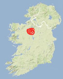
Rathcroghan Royal Site, Co. Roscommon
Nearest Town: Tulsk
Latitude: 53° 48′ 5.52″ N
Longitude: 8° 18′ 12.88″ W
A satellite view with the monuments indicated may be seen here.
We are indebted to Professor John Waddell, whose research and enlightened observations were an inspiration for this essay. His books, Rathcroghan: Archaeological and Geophysical Survey in a Ritual Landscape (2009), and Archaeology and Celtic Myth: An Exploration (2014) are the primary sources for further research. “Archaeology and Celtic Myth” is also the title of his presentation for the 2014 Rhind Lecture Series.
Many thanks to archaeologist Gary Dempsey (Gearóid Ó Díomasaigh) who accompanied us to some of the Rathcroghan monuments, a number of which we may not have located without his help.
external link:
Cruachan Aí Visitor Centre & Rathcroghan Tours